
Guidebook for Santa Barbara
Food Scene
Creative American eats from regional ingredients are served outdoors with local beers, wines & mixed drinks.
Menu Link: https://shalhoob.com/menu
41 ντόπιοι το προτείνουν
Funk Zone Patio
220 Gray AveCreative American eats from regional ingredients are served outdoors with local beers, wines & mixed drinks.
Menu Link: https://shalhoob.com/menu
Lure Fish House was created with the goal of providing you with a Top Tier Seafood Experience featuring fresh and sustainable seafood from trusted sources.
Menu Link: https://www.lurefishhouse.com/location/lure-fish-house-santa-barbara/#menus/
164 ντόπιοι το προτείνουν

Lure Fish House
60 S California StLure Fish House was created with the goal of providing you with a Top Tier Seafood Experience featuring fresh and sustainable seafood from trusted sources.
Menu Link: https://www.lurefishhouse.com/location/lure-fish-house-santa-barbara/#menus/
Local favorite chainlet serving Mexican comfort food & margaritas amidst south-of-the-border décor.
Menu Link: https://www.losarroyos.net/santa-barbara
36 ντόπιοι το προτείνουν

Los Arroyos Montecito Mexican Restaurant & Take Out
1280 Coast Village RdLocal favorite chainlet serving Mexican comfort food & margaritas amidst south-of-the-border décor.
Menu Link: https://www.losarroyos.net/santa-barbara
Innovative sushi, nigiri & sake served in a lively brick-walled space with featured local art.
Menu Link: https://www.arigatosb.com/wp-content/uploads/2022/03/MARCH5.2022.pdf
150 ντόπιοι το προτείνουν
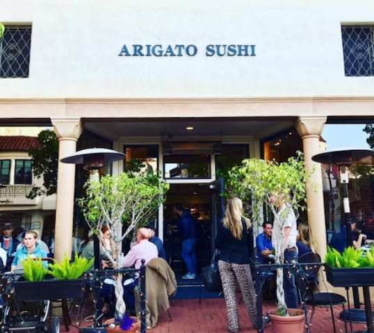
Arigato Sushi
1225 State StInnovative sushi, nigiri & sake served in a lively brick-walled space with featured local art.
Menu Link: https://www.arigatosb.com/wp-content/uploads/2022/03/MARCH5.2022.pdf
Californian French cuisine made with organic farm-fresh ingredients & paired with local wines.
Menu Link: https://www.bouchonsantabarbara.com/menus
58 ντόπιοι το προτείνουν

bouchon Santa Barbara
9 West Victoria StreetCalifornian French cuisine made with organic farm-fresh ingredients & paired with local wines.
Menu Link: https://www.bouchonsantabarbara.com/menus
Sushi eatery with unique rolls featuring truffle oil & habanero peppers.
Menu Link: https://sb.sakanahe.com/
23 ντόπιοι το προτείνουν
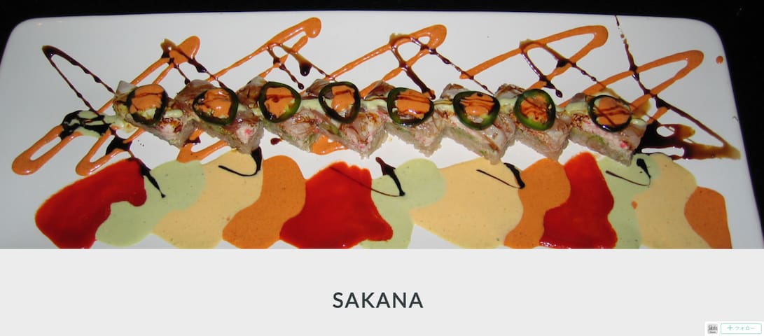
Sakana Sushi Bar & Japanese
1046 Coast Village RdSushi eatery with unique rolls featuring truffle oil & habanero peppers.
Menu Link: https://sb.sakanahe.com/
Fresh, locally caught seafood & signature Bloody Mary's in a hip, harborside location.
Menu Link: https://www.brophybros.com/menus
203 ντόπιοι το προτείνουν
Brophy Bros.
119 Harbor WayFresh, locally caught seafood & signature Bloody Mary's in a hip, harborside location.
Menu Link: https://www.brophybros.com/menus
Combo pizzeria & coffeehouse featuring java, wood-oven pies & pastries in low-key digs with a patio.
Menu Link: https://www.luckypennysb.com/menu/
48 ντόπιοι το προτείνουν

Lucky Penny
127 Anacapa StCombo pizzeria & coffeehouse featuring java, wood-oven pies & pastries in low-key digs with a patio.
Menu Link: https://www.luckypennysb.com/menu/
Sightseeing
University of California, Santa Barbara
Mission Santa Barbara is a Spanish mission in Santa Barbara, California. Often referred to as the ‘Queen of the Missions. The grounds consist of lush rose gardens and open grass fields over looking Down Town Santa Barbara and the ocean. The perfect place for a picnic or soaking up the sun.
72 ντόπιοι το προτείνουν
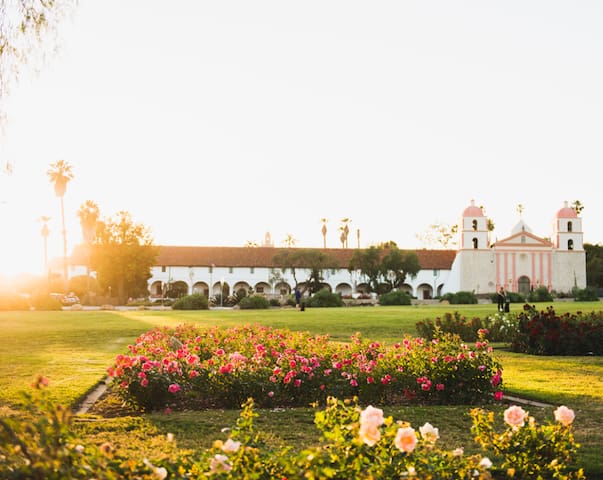
Mission Rose Garden
420 Plaza RubioMission Santa Barbara is a Spanish mission in Santa Barbara, California. Often referred to as the ‘Queen of the Missions. The grounds consist of lush rose gardens and open grass fields over looking Down Town Santa Barbara and the ocean. The perfect place for a picnic or soaking up the sun.
Drinks & Nightlife
Visit Santa Barbara’s Funk Zone, complete with boutique tasting rooms, cafes, galleries, live music and shops that cater to Santa Barbara’s contemporary side.
41 ντόπιοι το προτείνουν
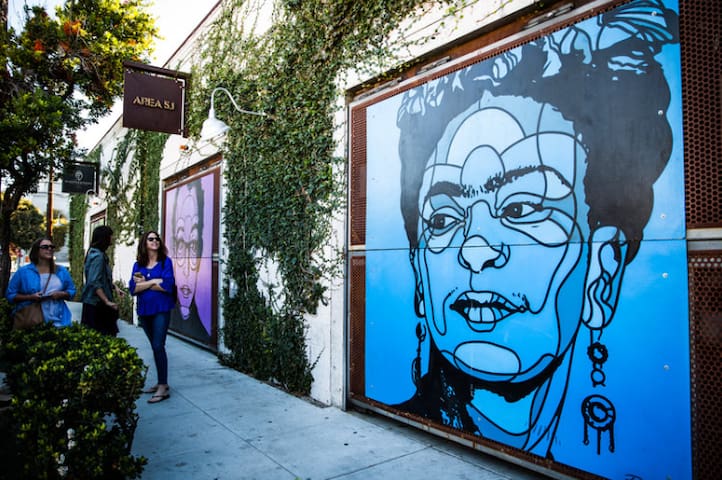
Funk Zone Patio
220 Gray AveVisit Santa Barbara’s Funk Zone, complete with boutique tasting rooms, cafes, galleries, live music and shops that cater to Santa Barbara’s contemporary side.
Handcrafted exotic cocktails in kitschy mugs are the draw at this breezy, tiki-style watering hole.
Menu Link: http://www.testpilotcocktails.com/menu
15 ντόπιοι το προτείνουν

Test Pilot
211 Helena AveHandcrafted exotic cocktails in kitschy mugs are the draw at this breezy, tiki-style watering hole.
Menu Link: http://www.testpilotcocktails.com/menu
Swanky bar with leather banquettes offering a changing menu of inventive cocktails & live jazz.
Menu Link: http://www.goodlioncocktails.com/menu
65 ντόπιοι το προτείνουν

The Good Lion
1212 State StSwanky bar with leather banquettes offering a changing menu of inventive cocktails & live jazz.
Menu Link: http://www.goodlioncocktails.com/menu
Local beer & wine offered in a cool, relaxed space with country-style décor, games & outdoor seats.
13 ντόπιοι το προτείνουν

Santa Barbara Wine Therapy
12 W Haley StLocal beer & wine offered in a cool, relaxed space with country-style décor, games & outdoor seats.
Warmly swank, red-&-brick-exposed venue serving cocktails, beers & wine alongside live music.
Menu Link: https://theredpiano.com/menu
30 ντόπιοι το προτείνουν

The Red Piano
519 State StWarmly swank, red-&-brick-exposed venue serving cocktails, beers & wine alongside live music.
Menu Link: https://theredpiano.com/menu
Festive Mexican eatery & bar has happy hours, parties & a partially outdoor space with fire pits.
Menu Link: https://sandbarsb.com/food/
21 ντόπιοι το προτείνουν

Sandbar
514 State StFestive Mexican eatery & bar has happy hours, parties & a partially outdoor space with fire pits.
Menu Link: https://sandbarsb.com/food/
Wine Tasting
Bill Wathen and Dick Doré, also known as the "Foxen Boys", have been making wine together since 1985 when they founded Foxen on the historic Rancho Tinaquaic in northern Santa Barbara County. Since that time, their dedication has remained the same - the creation of small production, sustainably-farmed, vineyard-focused wines using a minimalist approach to winemaking.
Website: https://www.foxenvineyard.com/
14 ντόπιοι το προτείνουν

Foxen Vineyard & Winery
7600 Foxen Canyon RdBill Wathen and Dick Doré, also known as the "Foxen Boys", have been making wine together since 1985 when they founded Foxen on the historic Rancho Tinaquaic in northern Santa Barbara County. Since that time, their dedication has remained the same - the creation of small production, sustainably-farmed, vineyard-focused wines using a minimalist approach to winemaking.
Website: https://www.foxenvineyard.com/
Brick Barn Wine Estate founder, Norman Williams, originally purchased this land in 1968. Shortly thereafter, the property became home to an Arabian horse farm, replete with a 36-stall brick barn created by an Italian stonemason in the early 1970s.
Norman and his wife Kathleen were drawn to the idea of growing grapes—and ultimately making wine. They saw immense promise in the land, and they knew that its distinct location could create exceptional wines. In 2013, they planted 35 acres and the specific varieties were chosen for their synergy with the estate’s unique growing conditions.
The original brick barn has now been reimagined as a winery and gathering place, while other portions of the ranch continue to be dedicated to organic vegetable farming and cattle ranching.
Website: https://www.brickbarnwineestate.com/
7 ντόπιοι το προτείνουν

Brick Barn Wine Estate
795 W Hwy 246Brick Barn Wine Estate founder, Norman Williams, originally purchased this land in 1968. Shortly thereafter, the property became home to an Arabian horse farm, replete with a 36-stall brick barn created by an Italian stonemason in the early 1970s.
Norman and his wife Kathleen were drawn to the idea of growing grapes—and ultimately making wine. They saw immense promise in the land, and they knew that its distinct location could create exceptional wines. In 2013, they planted 35 acres and the specific varieties were chosen for their synergy with the estate’s unique growing conditions.
The original brick barn has now been reimagined as a winery and gathering place, while other portions of the ranch continue to be dedicated to organic vegetable farming and cattle ranching.
Website: https://www.brickbarnwineestate.com/
Winery modelled on a French villa with a lavender-filled courtyard & wine caves, plus tastings.
Website: https://sunstonewinery.com/
32 ντόπιοι το προτείνουν

Οινοποιείο και Βίλα Sunstone
N Refugio RdWinery modelled on a French villa with a lavender-filled courtyard & wine caves, plus tastings.
Website: https://sunstonewinery.com/
According to our head winemaker Jill Russell, "Happy people make great wine." It’s a simple idea, but it’s true. Here at Cambria Estate Winery, we love our work. Maybe it’s the land, maybe it’s the team—maybe it’s just from drinking and sharing all that delicious wine—but we can’t think of a better place to be than our estate in the Santa Maria Valley.
Just a 40-minute drive from one of California’s top surf spots in the Pacific Ocean, you’ll find the Santa Maria Valley AVA, a stretch of land we call home. Our founders, Barbara Banke and Jess Jackson, however, saw Santa Barbara County as more than a beautiful spot (within that 40-minute drive you transition from gorgeous beaches to rolling mountains and farmland). They knew they were part of a group of pioneers who were onto something big, some-thing exciting — something that was going to add a new chapter to the story of California wine.
Website: https://www.cambriawines.com/
Cambria Winery
5475 Chardonnay LnAccording to our head winemaker Jill Russell, "Happy people make great wine." It’s a simple idea, but it’s true. Here at Cambria Estate Winery, we love our work. Maybe it’s the land, maybe it’s the team—maybe it’s just from drinking and sharing all that delicious wine—but we can’t think of a better place to be than our estate in the Santa Maria Valley.
Just a 40-minute drive from one of California’s top surf spots in the Pacific Ocean, you’ll find the Santa Maria Valley AVA, a stretch of land we call home. Our founders, Barbara Banke and Jess Jackson, however, saw Santa Barbara County as more than a beautiful spot (within that 40-minute drive you transition from gorgeous beaches to rolling mountains and farmland). They knew they were part of a group of pioneers who were onto something big, some-thing exciting — something that was going to add a new chapter to the story of California wine.
Website: https://www.cambriawines.com/
Local Beaches (Things To Do)
Goleta Beach Park has a little bit of everything for just about anybody. It is a county run beach next to the University of California Santa Barbara and the Santa Barbara Airport. Though the beach is not within the City of Goleta boundaries, it is only a half mile away from "The Goodland." Word has it that Goleta Beach is the busiest beach in the county. Although it is close to the UCSB and the airport, ground and air traffic seem very far away. The parking is free.
Amenities:
-BBQs, Boat Launch, Grass Park, Horseshoes, Kids Play Area, Paved Bike Path, Picnic Tables, Pier, Restaurant, Restrooms, -Volleyball Courts
-Activities: Biking, Boating, Fishing, Kayaking, Picnicking, Stand-Up Paddle boarding, Sunbathing, Volleyball, Walking
-Dog Policy: Dogs allowed on leash
52 ντόπιοι το προτείνουν
Παραλία Goleta
5986 Sandspit RdGoleta Beach Park has a little bit of everything for just about anybody. It is a county run beach next to the University of California Santa Barbara and the Santa Barbara Airport. Though the beach is not within the City of Goleta boundaries, it is only a half mile away from "The Goodland." Word has it that Goleta Beach is the busiest beach in the county. Although it is close to the UCSB and the airport, ground and air traffic seem very far away. The parking is free.
Amenities:
-BBQs, Boat Launch, Grass Park, Horseshoes, Kids Play Area, Paved Bike Path, Picnic Tables, Pier, Restaurant, Restrooms, -Volleyball Courts
-Activities: Biking, Boating, Fishing, Kayaking, Picnicking, Stand-Up Paddle boarding, Sunbathing, Volleyball, Walking
-Dog Policy: Dogs allowed on leash
Haskell's Beach, formerly Tecolote Beach, has long been one of Goleta's best kept secrets. Haskell's Beach is at the base of the Bacara Resort in western Goleta. There is beach access and a parking area for the public use. A wide easy-graded path leads to a small park-like area with grass and picnic tables just above the beach. Here you will find the "Beach House" which has restrooms, showers, and a shaded alcove. At high tide Haskell's Beach is narrow. At other times you can walk the beach north past an oil pier to a remote area known as Naples Point. If you walk south on the beach you'll be below the Sandpiper Golf Course and eventually get to Ellwood Beach.
Amenities:
-Grass Park, Picnic Tables, Restrooms, Showers
-Activities: Beach Walking, Sunbathing, Surfing
-Dog Policy: Dogs allowed on leash
12 ντόπιοι το προτείνουν
Haskell's Beach
Haskell's Beach, formerly Tecolote Beach, has long been one of Goleta's best kept secrets. Haskell's Beach is at the base of the Bacara Resort in western Goleta. There is beach access and a parking area for the public use. A wide easy-graded path leads to a small park-like area with grass and picnic tables just above the beach. Here you will find the "Beach House" which has restrooms, showers, and a shaded alcove. At high tide Haskell's Beach is narrow. At other times you can walk the beach north past an oil pier to a remote area known as Naples Point. If you walk south on the beach you'll be below the Sandpiper Golf Course and eventually get to Ellwood Beach.
Amenities:
-Grass Park, Picnic Tables, Restrooms, Showers
-Activities: Beach Walking, Sunbathing, Surfing
-Dog Policy: Dogs allowed on leash
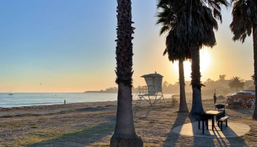
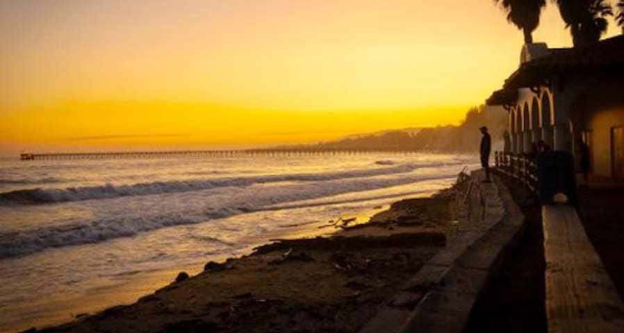
East Beach is located at the eastern end of the four-mile stretch of City beach parks. East Beach offers picnic facilities, more than a dozen volleyball courts, a playground, and beautiful ocean views.
East Beach is host to several volley ball tournaments each year at the world famous courts. A bike path and sidewalk extend from the Andrée Clark Bird Refuge, along East Beach and other City beaches.
Enjoy ocean swimming? Come join the community and family fun every Thursday evening in the summer at Reef & Run.
For kayaking and SUP needs, visit East Beach Rentals.
Dogs are not allowed on East Beach.
90 ντόπιοι το προτείνουν
East Beach Tacos
226 S Milpas StEast Beach is located at the eastern end of the four-mile stretch of City beach parks. East Beach offers picnic facilities, more than a dozen volleyball courts, a playground, and beautiful ocean views.
East Beach is host to several volley ball tournaments each year at the world famous courts. A bike path and sidewalk extend from the Andrée Clark Bird Refuge, along East Beach and other City beaches.
Enjoy ocean swimming? Come join the community and family fun every Thursday evening in the summer at Reef & Run.
For kayaking and SUP needs, visit East Beach Rentals.
Dogs are not allowed on East Beach.
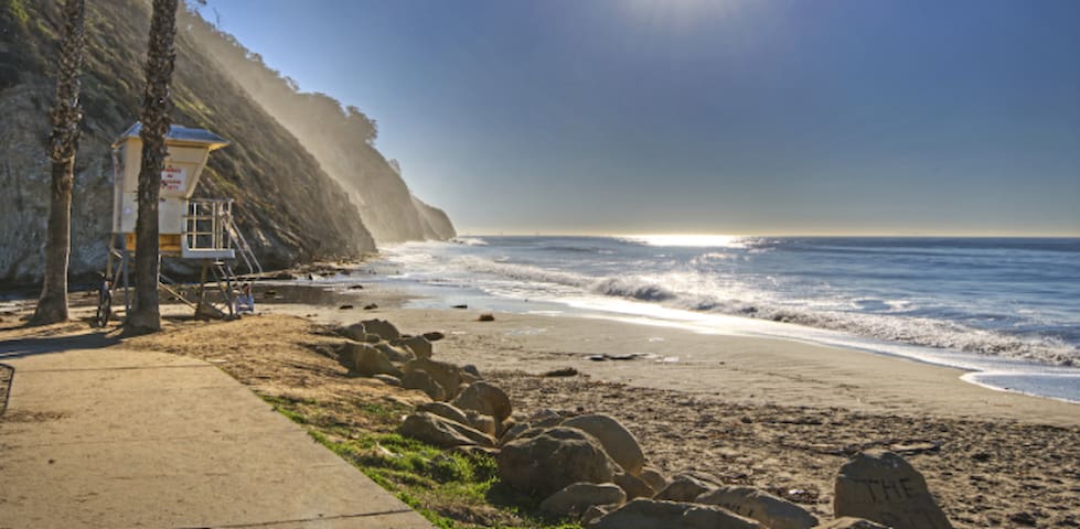
Officially named "Arroyo Burro Beach Park," this beach is just a ten minute drive along the Coast from downtown Santa Barbara. Hendry's is secluded by towering cliffs and a curving coastline. Surfers and children vie for territory as the waves tumble into shore. Hendry's is centrally located to a great deal of other fun. Eling's Park is a half mile up Las Positas so you will often see paragliders launching from nearby cliffs. A centerpiece of the beach is the Boathouse Restaurant and a snack bar.
Amenities: Accessible Features, Dog Wash, BBQs, Grass Park, Lifeguard, Picnic Tables, Restaurant, Restrooms, Showers, Trails
Activities:
-Beachcombing, Beach Walking, Bodyboarding, Fishing, Hiking, Sunbathing, Swimming
-Dog Policy: Dogs allowed off leash on the beach east (left as you face the ocean) of Arroyo Burro Creek, and on-leash in the rest of the beach and park
155 ντόπιοι το προτείνουν
Παραλία Hendrys
Officially named "Arroyo Burro Beach Park," this beach is just a ten minute drive along the Coast from downtown Santa Barbara. Hendry's is secluded by towering cliffs and a curving coastline. Surfers and children vie for territory as the waves tumble into shore. Hendry's is centrally located to a great deal of other fun. Eling's Park is a half mile up Las Positas so you will often see paragliders launching from nearby cliffs. A centerpiece of the beach is the Boathouse Restaurant and a snack bar.
Amenities: Accessible Features, Dog Wash, BBQs, Grass Park, Lifeguard, Picnic Tables, Restaurant, Restrooms, Showers, Trails
Activities:
-Beachcombing, Beach Walking, Bodyboarding, Fishing, Hiking, Sunbathing, Swimming
-Dog Policy: Dogs allowed off leash on the beach east (left as you face the ocean) of Arroyo Burro Creek, and on-leash in the rest of the beach and park
Local Hiking Trails (Things To Do)
TRAIL INFORMATION
-Distance—1.5 miles to Seven Falls; 1.5 miles to Mission Falls
-Elevation Gain—400’ to Seven Falls; 1750’ to the intersection Tunnel Trail at Mission Falls
-Difficulty—Easy to Seven Falls; hard core to Mission Falls
Topo—Santa Barbara
HIGHLIGHTS
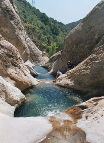
Both the east and west forks of Mission Creek have eroded through the highly resistant Coldwater Sandstone forming in the upper off-trail sections a series of narrows with deep pools, steep falls, and rich green fern coverings—the fabled Seven Falls. For hundreds of thousands of years erosive forces have eaten away at the Matilija Sandstone which forms the bulk of La Cumbre Peak, and the grinding power of the sand and water as they tumbled downhill has etched magical shapes in the rock formations below. One of these is a series of small falls and deep potholes known for more than a century as Seven Falls.
DIRECTIONS
From the Santa Barbara Mission drive up Mission Canyon Road to Foothill and turn right, then turn left several hundred yards later (by the fire station). Continue up Mission Canyon to the Tunnel Road turnoff, a half mile before the Botanic Garden. Continue several miles to the end. Park properly. The police frequently ticket illegally parked cars. The trail begins about three-quarters mile beyond the locked gate.
28 ντόπιοι το προτείνουν
Seven Falls
Tunnel RoadTRAIL INFORMATION
-Distance—1.5 miles to Seven Falls; 1.5 miles to Mission Falls
-Elevation Gain—400’ to Seven Falls; 1750’ to the intersection Tunnel Trail at Mission Falls
-Difficulty—Easy to Seven Falls; hard core to Mission Falls
Topo—Santa Barbara
HIGHLIGHTS
Both the east and west forks of Mission Creek have eroded through the highly resistant Coldwater Sandstone forming in the upper off-trail sections a series of narrows with deep pools, steep falls, and rich green fern coverings—the fabled Seven Falls. For hundreds of thousands of years erosive forces have eaten away at the Matilija Sandstone which forms the bulk of La Cumbre Peak, and the grinding power of the sand and water as they tumbled downhill has etched magical shapes in the rock formations below. One of these is a series of small falls and deep potholes known for more than a century as Seven Falls.
DIRECTIONS
From the Santa Barbara Mission drive up Mission Canyon Road to Foothill and turn right, then turn left several hundred yards later (by the fire station). Continue up Mission Canyon to the Tunnel Road turnoff, a half mile before the Botanic Garden. Continue several miles to the end. Park properly. The police frequently ticket illegally parked cars. The trail begins about three-quarters mile beyond the locked gate.
For a usually warm, usually busy, always beautiful half-day hike in Santa Barbara, Inspiration Point by way of the Tunnel Trail, is a great bet. Not to be confused with the Inspiration Point offshore on Anacapa Island or the hike to Inspiration Point in the San Gabriel Mountains by way of Echo Mountain, this Inspiration Point rewards hikers with stunning views of the greater Santa Barbara area, including the northern Channel Islands. It's typically buzzing with hikers, joggers, mountain bikers, and dog walkers on a sunny day and for good reason. This 3.5-mile hike climbs an attainable 800 feet, the trail is well maintained, and it offers some of the best sightseeing in the area.
Most hikers choose to approach the hike by way of the dog-friendly Tunnel Trail, though for those craving a longer day, Jesuita Trail from San Roque road is a 7.5-mile round trip. Regardless of which path you take, the sweeping vista at Inspiration Point encapsulates Santa Barbara down below and broad perspectives of the Pacific's Santa Barbara Channel and Channel Islands. That’s not to undermine the varying and interesting views peppered along the hike itself. The trail meanders through Mission Canyon, a wide draw that is punctuated with the intriguing sandstone formation named The Mission Crags. Tantalizing glimpses of the ocean move in and out of view as the trail winds up toward the summit, and along with it, vistas of the Santa Barbara wharf, and the mission style architecture of the downtown.
The hike traverses through the varied topography of the Santa Ynez Mountains. As the westernmost of the Transverse Ranges, this extremely narrow range of mountains (by mountain range standards) rises sharply in the north and drops off almost equally as dramatically on its southern edge. This young range is characterized by the abundance of exposed, craggy sandstone—it’s evident that some local climbers have established intermittent and relatively easy bouldering routes here. Also abundant are the seemingly endless sloping shale fields, upturned by the still-active Santa Ynez Fault.
46 ντόπιοι το προτείνουν
Inspiration Point
For a usually warm, usually busy, always beautiful half-day hike in Santa Barbara, Inspiration Point by way of the Tunnel Trail, is a great bet. Not to be confused with the Inspiration Point offshore on Anacapa Island or the hike to Inspiration Point in the San Gabriel Mountains by way of Echo Mountain, this Inspiration Point rewards hikers with stunning views of the greater Santa Barbara area, including the northern Channel Islands. It's typically buzzing with hikers, joggers, mountain bikers, and dog walkers on a sunny day and for good reason. This 3.5-mile hike climbs an attainable 800 feet, the trail is well maintained, and it offers some of the best sightseeing in the area.
Most hikers choose to approach the hike by way of the dog-friendly Tunnel Trail, though for those craving a longer day, Jesuita Trail from San Roque road is a 7.5-mile round trip. Regardless of which path you take, the sweeping vista at Inspiration Point encapsulates Santa Barbara down below and broad perspectives of the Pacific's Santa Barbara Channel and Channel Islands. That’s not to undermine the varying and interesting views peppered along the hike itself. The trail meanders through Mission Canyon, a wide draw that is punctuated with the intriguing sandstone formation named The Mission Crags. Tantalizing glimpses of the ocean move in and out of view as the trail winds up toward the summit, and along with it, vistas of the Santa Barbara wharf, and the mission style architecture of the downtown.
The hike traverses through the varied topography of the Santa Ynez Mountains. As the westernmost of the Transverse Ranges, this extremely narrow range of mountains (by mountain range standards) rises sharply in the north and drops off almost equally as dramatically on its southern edge. This young range is characterized by the abundance of exposed, craggy sandstone—it’s evident that some local climbers have established intermittent and relatively easy bouldering routes here. Also abundant are the seemingly endless sloping shale fields, upturned by the still-active Santa Ynez Fault.
The hike begins at the main Cold Spring Trail After a gentle uphill for 1/4 of a mile you reach a bench by the creek where you can sit and clear your mind with the gentle sounds of small waterfalls. This bench is at the junction to the West Fork of Cold Spring Trail. Cross the creek at the bench and continue up the hill for about 3 more miles, passing a historical, landmark water tunnel along the way to the summit at Gibraltar Rd.
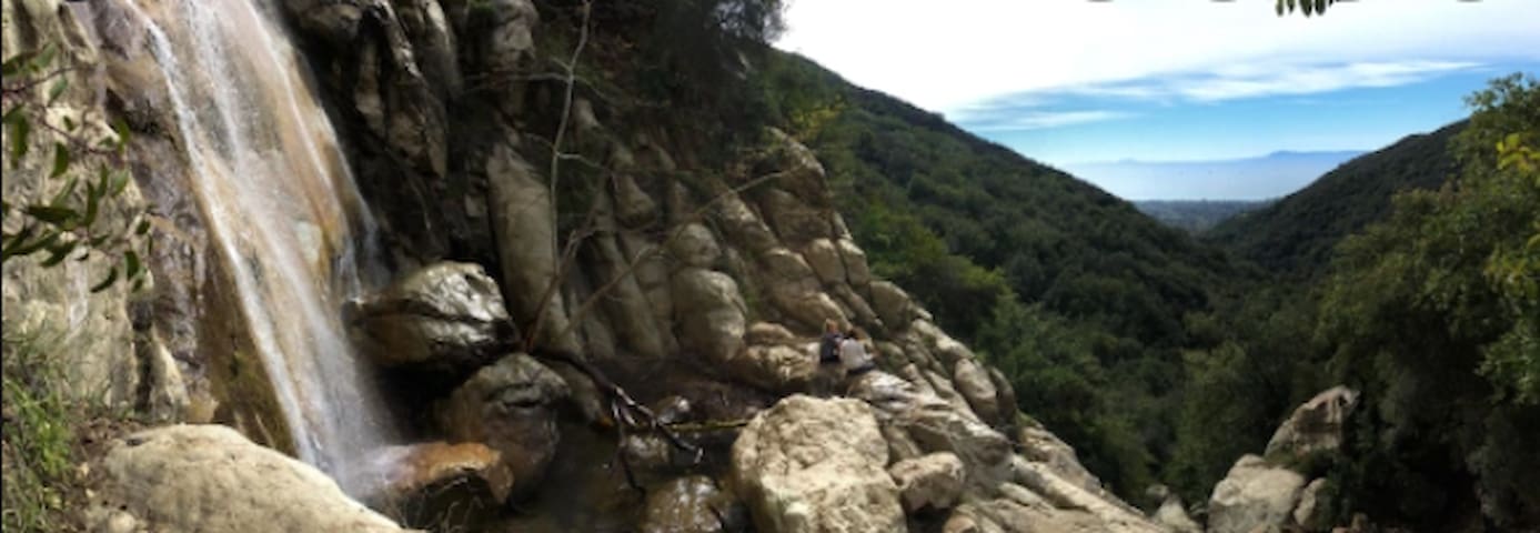
For a variation, there is a small junction you come to well before the summit at Gibraltar Rd. Follow this primitive trail along the creek to a waterfall known as Tangerine Falls. It's quite an adventurous rock-hopping kind of a trail, and at some places, not a trail for the faint of heart.
Also, not far along after you turn off toward Tangerine falls there is another turnoff to the left as you follow the water pipe. This trail will take you steeply to a nice rock outcrop at the top of the falls. You can't see the falls from this outcrop, but you can enjoy the lofty perch just as well. Continuing along this trail, a little exploration on your part and you might discover something interesting at the end of this trail—a structure some of us call the homestead. Or you may find yourself sweating up a steep hill toward the top of the mountains, if that part of the trail still exists.
The total mileage for the basic West Fork to Gibraltar Rd. trail is 3.5 miles round trip. For Tangerine Falls it is closer to 3 miles round trip.
Tangerine Falls
The hike begins at the main Cold Spring Trail After a gentle uphill for 1/4 of a mile you reach a bench by the creek where you can sit and clear your mind with the gentle sounds of small waterfalls. This bench is at the junction to the West Fork of Cold Spring Trail. Cross the creek at the bench and continue up the hill for about 3 more miles, passing a historical, landmark water tunnel along the way to the summit at Gibraltar Rd.
For a variation, there is a small junction you come to well before the summit at Gibraltar Rd. Follow this primitive trail along the creek to a waterfall known as Tangerine Falls. It's quite an adventurous rock-hopping kind of a trail, and at some places, not a trail for the faint of heart.
Also, not far along after you turn off toward Tangerine falls there is another turnoff to the left as you follow the water pipe. This trail will take you steeply to a nice rock outcrop at the top of the falls. You can't see the falls from this outcrop, but you can enjoy the lofty perch just as well. Continuing along this trail, a little exploration on your part and you might discover something interesting at the end of this trail—a structure some of us call the homestead. Or you may find yourself sweating up a steep hill toward the top of the mountains, if that part of the trail still exists.
The total mileage for the basic West Fork to Gibraltar Rd. trail is 3.5 miles round trip. For Tangerine Falls it is closer to 3 miles round trip.
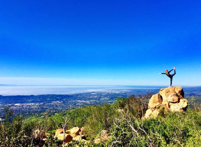
A truly iconic spot for Santa Barbara hikers is the exposed clearing at Saddle Rock 2.75 miles from the trailhead. An almost 180 degree ocean view coupled with a large rock formation perfect for perching entices people daily. Another fun not-so-secret? Hikers regularly arrange rocks in different large shapes like peace signs and hearts that are more than 40 feet across. There have even been marriage proposals spelled out in rocks.
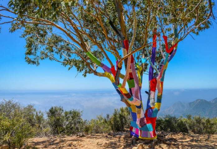
This trail recently blossomed in popularity as yarn bomber Stephen Duneier (with the help of several others) knitted a colorful cover for Saddlerock itself. Yarn bombing is usually a guerilla act of wrapping a tree, a pole, a bench or in this case a giant rock with knitted or crocheted covering. While the art only lasted 9 nine days, the crowds were wowed and left asking for more.
The trail is steep at times but the views from the top are magnificent. On a clear day the Channel Islands emerge from the horizon and it feels like you can see all the way to Los Angeles to the south. If you are feeling spry, the trail does not end there. Continue on your way to the fire road (cat way, if you're a local) and you can turn your adventure into a 6-mile loop also known as the Girard Loop.
To find the trailhead, exit Highway 101 at Hot Springs Road and head towards the mountains and away from the coast. Turn left at East Valley Road. Trailhead is 0.2 miles on your right.
Saddle Rock Trail
Saddle Rock TrailA truly iconic spot for Santa Barbara hikers is the exposed clearing at Saddle Rock 2.75 miles from the trailhead. An almost 180 degree ocean view coupled with a large rock formation perfect for perching entices people daily. Another fun not-so-secret? Hikers regularly arrange rocks in different large shapes like peace signs and hearts that are more than 40 feet across. There have even been marriage proposals spelled out in rocks.
This trail recently blossomed in popularity as yarn bomber Stephen Duneier (with the help of several others) knitted a colorful cover for Saddlerock itself. Yarn bombing is usually a guerilla act of wrapping a tree, a pole, a bench or in this case a giant rock with knitted or crocheted covering. While the art only lasted 9 nine days, the crowds were wowed and left asking for more.
The trail is steep at times but the views from the top are magnificent. On a clear day the Channel Islands emerge from the horizon and it feels like you can see all the way to Los Angeles to the south. If you are feeling spry, the trail does not end there. Continue on your way to the fire road (cat way, if you're a local) and you can turn your adventure into a 6-mile loop also known as the Girard Loop.
To find the trailhead, exit Highway 101 at Hot Springs Road and head towards the mountains and away from the coast. Turn left at East Valley Road. Trailhead is 0.2 miles on your right.