
Alan's Guidebook
Sightseeing
Chatsworth House is a stately home in the Derbyshire Dales, 3.5 miles (5.6 km) north-east of Bakewell and 9 miles (14 km) west of Chesterfield, England. The seat of the Duke of Devonshire, it has belonged to the Cavendish family since 1549. It stands on the east bank of the River Derwent, across from hills between the Derwent and Wye valleys, amid parkland backed by wooded hills that rise to heather moorland. The house holds major collections of paintings, furniture, Old Master drawings, neoclassical sculptures and books. Chosen several times as Britain's favourite country house,[2][3] it is a Grade I listed property from the 17th century, altered in the 18th and 19th centuries.[4][5] In 2011–2012 it underwent a £14-million restoration.[4] The owner is the Chatsworth House Trust, an independent charitable foundation, on behalf of the Cavendish family.[6]
698 ντόπιοι το προτείνουν
Τσάτσγουορθ Χάους
Chatsworth House is a stately home in the Derbyshire Dales, 3.5 miles (5.6 km) north-east of Bakewell and 9 miles (14 km) west of Chesterfield, England. The seat of the Duke of Devonshire, it has belonged to the Cavendish family since 1549. It stands on the east bank of the River Derwent, across from hills between the Derwent and Wye valleys, amid parkland backed by wooded hills that rise to heather moorland. The house holds major collections of paintings, furniture, Old Master drawings, neoclassical sculptures and books. Chosen several times as Britain's favourite country house,[2][3] it is a Grade I listed property from the 17th century, altered in the 18th and 19th centuries.[4][5] In 2011–2012 it underwent a £14-million restoration.[4] The owner is the Chatsworth House Trust, an independent charitable foundation, on behalf of the Cavendish family.[6]
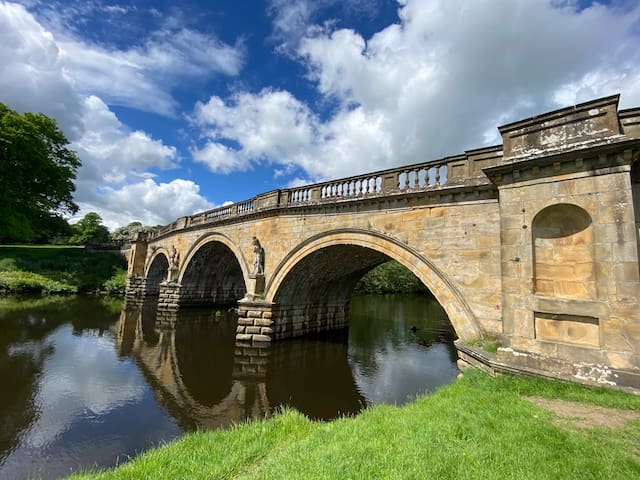
Baslow is a village in Derbyshire, England, in the Peak District, situated between Sheffield and Bakewell, just over 1 mile (1.6 km) north of Chatsworth House. It is sited by the River Derwent, which is spanned by a 17th-century bridge, alongside which is a contemporary toll house.
10 ντόπιοι το προτείνουν
Baslow
Baslow is a village in Derbyshire, England, in the Peak District, situated between Sheffield and Bakewell, just over 1 mile (1.6 km) north of Chatsworth House. It is sited by the River Derwent, which is spanned by a 17th-century bridge, alongside which is a contemporary toll house.
Bakewell is a market town and civil parish in the Derbyshire Dales district of Derbyshire, England, known also for its local Bakewell pudding. It lies on the River Wye, about 13 miles (21 km) south-west of Sheffield. In the 2011 census, the population of the civil parish appeared as 3,949.[1] It was estimated at 3,695 in 2019.[2] The town is close to the tourist attractions of Chatsworth House and Haddon Hall.
375 ντόπιοι το προτείνουν
Bakewell
Bakewell is a market town and civil parish in the Derbyshire Dales district of Derbyshire, England, known also for its local Bakewell pudding. It lies on the River Wye, about 13 miles (21 km) south-west of Sheffield. In the 2011 census, the population of the civil parish appeared as 3,949.[1] It was estimated at 3,695 in 2019.[2] The town is close to the tourist attractions of Chatsworth House and Haddon Hall.
Barlow is a village and civil parish in the North East Derbyshire district of Derbyshire, England. According to the 2001 census the parish had a population of 884, increasing to 920 at the 2011 Census.[1] The village is about 4 miles north-west of Chesterfield.
Barlow
Barlow is a village and civil parish in the North East Derbyshire district of Derbyshire, England. According to the 2001 census the parish had a population of 884, increasing to 920 at the 2011 Census.[1] The village is about 4 miles north-west of Chesterfield.
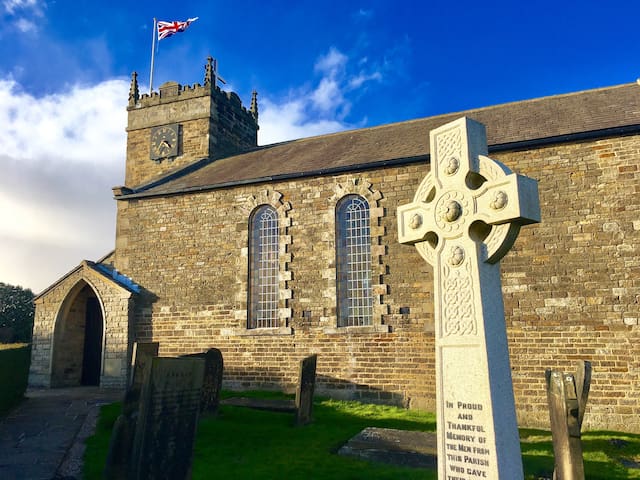
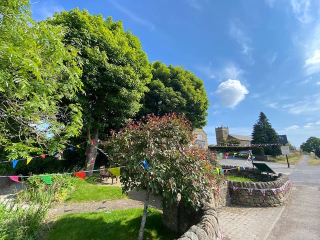
Holmesfield is a village and civil parish in the English county of Derbyshire. The population of the civil parish at the 2011 census was 971. The name "Holmesfield" means "raised pasture-land" and is of Norse and Anglo-Saxon origin. Viking influences are also evident with many road names suffixed by "gate", the old Norse word for "way".
Holmesfield
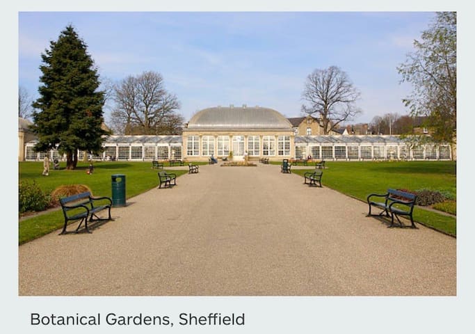
Sheffield is a city in South Yorkshire, England, serving as the administrative centre of the City of Sheffield. The name derives from the River Sheaf which runs through the city. It is historically part of the West Riding of Yorkshire and some of its southern suburbs were transferred from Derbyshire to the city council. It is the largest settlement in South
73 ντόπιοι το προτείνουν
Sheffield
Sheffield is a city in South Yorkshire, England, serving as the administrative centre of the City of Sheffield. The name derives from the River Sheaf which runs through the city. It is historically part of the West Riding of Yorkshire and some of its southern suburbs were transferred from Derbyshire to the city council. It is the largest settlement in South
Haddon Hall, the private residence of Lord and Lady Edward Manners, is set in the Peak District in the valley of the River Wye.
With nine hundred years of history, it is one of the oldest houses in the country and moreover one of the only houses in England to have remained in one family’s ownership for its entire existence.
Haddon is unique as it remained empty for nearly two hundred years
This extraordinary period, when time stood still in the Hall, allowed it to remain unaltered during the modernising period of the Georgians and Victorians. So venturing into Haddon is like stepping back in time, since from the 1700s the family preferred to live at their main seat, Belvoir Castle in Leicestershire.
The Medieval Banqueting Hall remains furnished with its original Dais table, behind which hangs a tapestry gifted to the family by visiting Henry VIII.
The Parlour boasts its glorious Tudor painted ceiling of Tudor roses and marvellous heraldic paneling.
Exquisite and very rare 15th century fresco seccos adorn the walls of the Medieval Chapel.
In contrast to the Tudor and Medieval Rooms below, the light and airy first floor Elizabethan rooms culminate in the spectacular 110ft Robert Smythson designed Long Gallery; reputed to be one of the most beautiful rooms in England.
The terraced Elizabethan Walled Gardens, known for their beauty and structure, cascade down to the River Wye and providing spectacular views of the ancient parkland and Peak District beyond. Recently re-designed by Chelsea Award winning garden designer, Arne Maynard, these make for an equally important part of any visit to the Hall.
260 ντόπιοι το προτείνουν
Haddon Hall
Haddon Hall, the private residence of Lord and Lady Edward Manners, is set in the Peak District in the valley of the River Wye.
With nine hundred years of history, it is one of the oldest houses in the country and moreover one of the only houses in England to have remained in one family’s ownership for its entire existence.
Haddon is unique as it remained empty for nearly two hundred years
This extraordinary period, when time stood still in the Hall, allowed it to remain unaltered during the modernising period of the Georgians and Victorians. So venturing into Haddon is like stepping back in time, since from the 1700s the family preferred to live at their main seat, Belvoir Castle in Leicestershire.
The Medieval Banqueting Hall remains furnished with its original Dais table, behind which hangs a tapestry gifted to the family by visiting Henry VIII.
The Parlour boasts its glorious Tudor painted ceiling of Tudor roses and marvellous heraldic paneling.
Exquisite and very rare 15th century fresco seccos adorn the walls of the Medieval Chapel.
In contrast to the Tudor and Medieval Rooms below, the light and airy first floor Elizabethan rooms culminate in the spectacular 110ft Robert Smythson designed Long Gallery; reputed to be one of the most beautiful rooms in England.
The terraced Elizabethan Walled Gardens, known for their beauty and structure, cascade down to the River Wye and providing spectacular views of the ancient parkland and Peak District beyond. Recently re-designed by Chelsea Award winning garden designer, Arne Maynard, these make for an equally important part of any visit to the Hall.
Hardwick Hall is one of the finest Elizabethan buildings in the country. A big claim but we’re confident you’ll agree. Full of architectural and artistic delights from Elizabethan embroidery to Forties furnishing, a walk through the Hall is always an enjoyable experience.
Bess of Hardwick
A remarkable house for a remarkable woman. Bess of Hardwick, a formidable and talented woman, was responsible for the creation of both Hardwick Hall and Chatsworth House. Her four marriages led to her becoming the Countess of Shrewsbury and one of the richest women in Elizabethan England.
97 ντόπιοι το προτείνουν
Εθνική Εμπιστοσύνη - Κάστρο Χάρντγουικ
Hardwick Hall is one of the finest Elizabethan buildings in the country. A big claim but we’re confident you’ll agree. Full of architectural and artistic delights from Elizabethan embroidery to Forties furnishing, a walk through the Hall is always an enjoyable experience.
Bess of Hardwick
A remarkable house for a remarkable woman. Bess of Hardwick, a formidable and talented woman, was responsible for the creation of both Hardwick Hall and Chatsworth House. Her four marriages led to her becoming the Countess of Shrewsbury and one of the richest women in Elizabethan England.
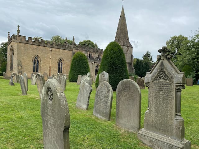
Castleton village was mentioned as Pechesers in Domesday Book in 1086 where "Arnbiorn and Hundingr held the land of William Peverel's castle in Castleton".This land and Peverel's castle were amongst the manors belonging to William Peverel that also included Bolsover and Glapwell.
St Edmund's Norman church was restored about 1837. It has late 13th-century tracery and an ashlar-faced Perpendicular tower. Its box pews are dated 1661, 1662, 1663 and 1676.
A medieval leper hospital (the Hospital of Saint Mary in the Peak) is thought to have been on the eastern boundary of Castleton, though some locals believe it to have been just south of the Speedwell Cavern footpath from the village. University of Sheffield archaeologists are investigating 'Castle of the Peak', which was reputedly founded by the wife of one of the William Peverels before 1153, and continued until about the 1543 Dissolution. They say the earliest documents referring to Spital Field are a grant and a Charter from the early 14th century. They are also investigating the 12th-century planned town at the foot of the castle hill.
Castleton had a long history of lead mining; the Odin Mine, one of the oldest lead mines in the country, is situated 1.5 kilometres (0.9 mi) west of the village (see also Derbyshire lead mining history). Researchers studying an ice core from a Swiss glacier have found that levels of lead air pollution across Europe during the period 1170–1216 was as high as those of the Industrial Revolution, and the principal source was Peak District mines such as Castleton and Wirksworth.[5][6][7] The mining created and enlarged local caverns, four of which are now open to the public as Peak Cavern, Blue John Cavern, Speedwell Cavern and Treak Cliff Cavern. A small amount of Blue John is mined locally.
Since the 1920s the main mineral industry in the area has been cement. Hope Cement Works is closer to Hope, but its quarry is closer to Castleton.
186 ντόπιοι το προτείνουν
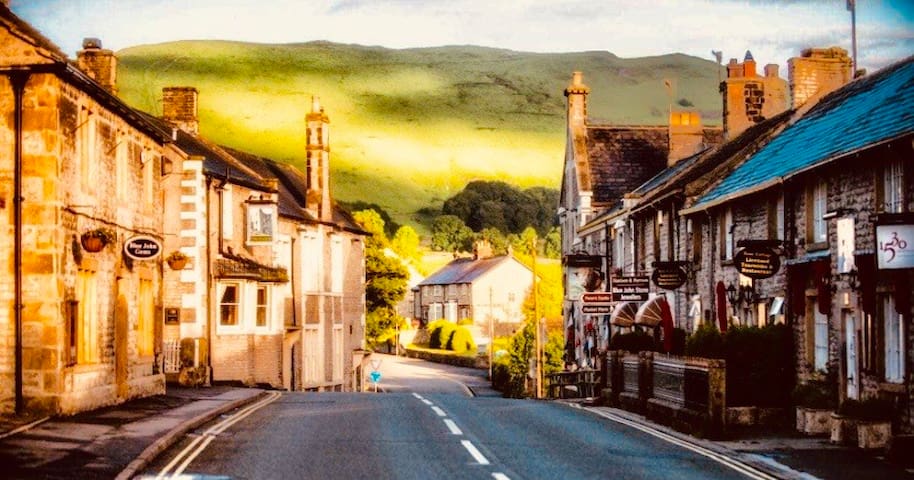
Castleton
Castleton village was mentioned as Pechesers in Domesday Book in 1086 where "Arnbiorn and Hundingr held the land of William Peverel's castle in Castleton".This land and Peverel's castle were amongst the manors belonging to William Peverel that also included Bolsover and Glapwell.
St Edmund's Norman church was restored about 1837. It has late 13th-century tracery and an ashlar-faced Perpendicular tower. Its box pews are dated 1661, 1662, 1663 and 1676.
A medieval leper hospital (the Hospital of Saint Mary in the Peak) is thought to have been on the eastern boundary of Castleton, though some locals believe it to have been just south of the Speedwell Cavern footpath from the village. University of Sheffield archaeologists are investigating 'Castle of the Peak', which was reputedly founded by the wife of one of the William Peverels before 1153, and continued until about the 1543 Dissolution. They say the earliest documents referring to Spital Field are a grant and a Charter from the early 14th century. They are also investigating the 12th-century planned town at the foot of the castle hill.
Castleton had a long history of lead mining; the Odin Mine, one of the oldest lead mines in the country, is situated 1.5 kilometres (0.9 mi) west of the village (see also Derbyshire lead mining history). Researchers studying an ice core from a Swiss glacier have found that levels of lead air pollution across Europe during the period 1170–1216 was as high as those of the Industrial Revolution, and the principal source was Peak District mines such as Castleton and Wirksworth.[5][6][7] The mining created and enlarged local caverns, four of which are now open to the public as Peak Cavern, Blue John Cavern, Speedwell Cavern and Treak Cliff Cavern. A small amount of Blue John is mined locally.
Since the 1920s the main mineral industry in the area has been cement. Hope Cement Works is closer to Hope, but its quarry is closer to Castleton.
Food scene
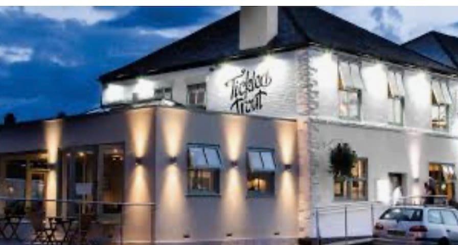
Great food at reasonable prices. Located in nearby village of Barlow
7 ντόπιοι το προτείνουν
The Tickled Trout
33 Valley RdGreat food at reasonable prices. Located in nearby village of Barlow
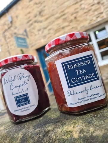
Edensor Tea Cottage
Award winning tea rooms on the Chatsworth estate.
Local pubs
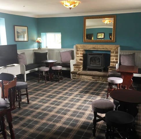
George And Dragon
Lovely old pub , 100 yards from our accommodation.
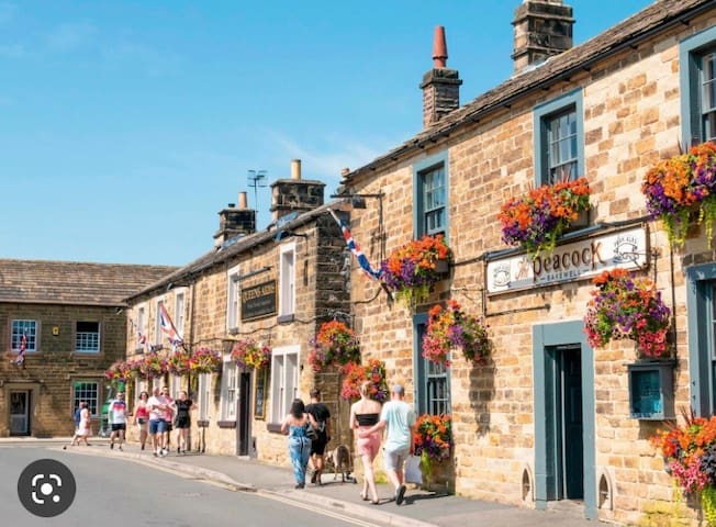
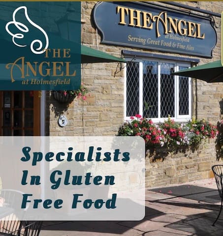
The Peacock At Barlow
Hackney LaneGreat location, craft beers and good food.
Holmesfield
Serving good food at a good price! Just across the road!!
Rutland Arms
A really old traditional pub on the edge of Holmesfield.
Walking, Hiking, Climbing
Froggatt Edge is frequented by rock climbers and hillwalkers throughout the year.
Joe Brown popularised two well-known classic routes in the late 1940s, Sunset Slab (HVS 4b) and Three Pebble Slab (HVS 5a). Whilst the climbing is not difficult, a fall from either climb (particularly Sunset Slab) would result in injuries. One of the best-known climbs at Froggatt Edge is "Downhill Racer", a smooth and near-vertical 17 m (50 ft) slab of gritstone. It was first climbed in 1977 by Pete Livesey and represented a breakthrough in that it combined difficulty with real danger: there is no suitable crack in the rock in which to place protection (to anchor a rope), so a climber who slips from the small finger holds will hit the ground. It is now graded E4 6a.
Climbing approaches
Froggatt Edge is considered the second most popular between the Eastern Edges. Due to its position the edge avoids the worst of the weather. Froggatt is famous for its slabs, but it also has a good amount of climbs including cracks.There are two usual approaches for climbing: the first one is from the parking on the B6045 located close to the Grouse Inn. 328 ft (100m) before the Froggatt Pinnacle is located the first section of the edge. There are a total of 472 climbs, the type of rock is gritstone, the edge is facing West and the altitude is 862 ft (263m).[1] The beginning of the most common approach is located 1640,42 ft (500m) South of the Grouse Inn at White Gate.[2
14 ντόπιοι το προτείνουν
Froggatt Edge
Froggatt Edge is frequented by rock climbers and hillwalkers throughout the year.
Joe Brown popularised two well-known classic routes in the late 1940s, Sunset Slab (HVS 4b) and Three Pebble Slab (HVS 5a). Whilst the climbing is not difficult, a fall from either climb (particularly Sunset Slab) would result in injuries. One of the best-known climbs at Froggatt Edge is "Downhill Racer", a smooth and near-vertical 17 m (50 ft) slab of gritstone. It was first climbed in 1977 by Pete Livesey and represented a breakthrough in that it combined difficulty with real danger: there is no suitable crack in the rock in which to place protection (to anchor a rope), so a climber who slips from the small finger holds will hit the ground. It is now graded E4 6a.
Climbing approaches
Froggatt Edge is considered the second most popular between the Eastern Edges. Due to its position the edge avoids the worst of the weather. Froggatt is famous for its slabs, but it also has a good amount of climbs including cracks.There are two usual approaches for climbing: the first one is from the parking on the B6045 located close to the Grouse Inn. 328 ft (100m) before the Froggatt Pinnacle is located the first section of the edge. There are a total of 472 climbs, the type of rock is gritstone, the edge is facing West and the altitude is 862 ft (263m).[1] The beginning of the most common approach is located 1640,42 ft (500m) South of the Grouse Inn at White Gate.[2
Stanage Edge, or simply Stanage (from "stone edge") is a gritstone escarpment in the Peak District, England, famous as a location for climbing. It lies a couple of miles to the north of Hathersage, and the northern part of the edge forms the border between the High Peak of Derbyshire and Sheffield in South Yorkshire. Its highest point is High Neb at 458 metres (1,503 ft) above sea level. Areas of Stanage were quarried in the past to produce grindstones, and some can still be seen on the hillside—carved, but never removed.
92 ντόπιοι το προτείνουν
Stanage Edge
Stanage Edge, or simply Stanage (from "stone edge") is a gritstone escarpment in the Peak District, England, famous as a location for climbing. It lies a couple of miles to the north of Hathersage, and the northern part of the edge forms the border between the High Peak of Derbyshire and Sheffield in South Yorkshire. Its highest point is High Neb at 458 metres (1,503 ft) above sea level. Areas of Stanage were quarried in the past to produce grindstones, and some can still be seen on the hillside—carved, but never removed.
Mam Tor is a 517 m (1,696 ft) hill near Castleton in the High Peak of Derbyshire, England. Its name means "mother hill",so called because frequent landslips on its eastern face have resulted in a multitude of "mini-hills" beneath it.These landslips, which are caused by unstable lower layers of shale, also give the hill its alternative name of Shivering Mountain.
134 ντόπιοι το προτείνουν
Mam Tor
Mam Tor is a 517 m (1,696 ft) hill near Castleton in the High Peak of Derbyshire, England. Its name means "mother hill",so called because frequent landslips on its eastern face have resulted in a multitude of "mini-hills" beneath it.These landslips, which are caused by unstable lower layers of shale, also give the hill its alternative name of Shivering Mountain.
Ladybower Reservoir Walk
Ladybower Reservoir is one of three linked reservoirs in the heart of the Peak District National Park. Here are 4 walks on the Derbyshire Walks App that take you up to the summit of Win Hill which is 463 m above sea level and offer wonderful views over Ladybower Reservoir and the Derwent Valley.
Ladybower Reservoir - Win Hill walk 1
4.25 miles
This is our shortest walk to the fantastic viewing point of Win Hill - at a height of 463 m above sea level. Whilst the walk is relatively short it is quite a long tough climb to the top. However, the views of the Ladybower reservoir (which was built between 1935 and 1943), and countryside surrounding it is amazing and well worth the effort. From there the route back to the reservoir is a slow, gentle descent mainly through forest. After your big climb you can pat yourself on the back and have some well deserved refreshments at The Yorkshire Bridge Inn just off the A6013 or the Ladybower Inn off the A57.
Ladybower Reservoir - Win Hill walk 2
6.5 miles
This is a slightly shorter version to the Win Hill Walk 4. The route is very similar but shorter. You will still get all of the amazing views of the beautiful Ladybower Reservoir and surrounding countryside and a lovely level walk near the reservoir at the end of the walk, but the descent down through the woodland will not be as steep. Well deserved refreshments can be found at The Yorkshire Bridge Inn just off the A6013 and the Ladybower Inn off the A57.
Ladybower Reservoir - Win Hill walk 3
7 miles
This walk will also take you up to the amazing viewpoint of Win Hill but takes you firstly along the side of the Derwent Valley and then on to the small village of Thornhill before taking the steady climb up to Win Hill. Before the big climb, if you are looking for a short break from the walk, we have added an optional there and back route to the attractive village of Bamford. This detour walks past Bamford Mill and its wonderful weir which was once a cotton mill, now sympathetically converted into rather smart apartments. From there you can follow the route into the village and have some refreshments at The Anglers Rest a lovely pub and cafe before retracing your steps back across the river ready for the uphill walk to Win Hill. After taking time to enjoy the stunning views of the beautiful Ladybower Reservoir and surrounding countryside the walk continues back downhill on woodland paths to the reservoir and back to your starting point. If you didn’t take the detour (and even if you did), you can get some well deserved refreshments after your walk at The Yorkshire Bridge Inn just off the A6013 or the Ladybower Inn off the A57.
Ladybower Reservoir - Win Hill walk 4
9 miles
This is our longest walk which takes you to the wonderful viewpoint of Win Hill - a height of 463 above sea level. You will need plenty of energy for this walk as it is quite long and there is a big steep climb up to Win Hill itself. However the views at the top of the Ladybower Reservoir and its surroundings is certainly a just reward. It is the only big hill on this walk and the rest of the walk is quite easy going starting on a wide grass covered ridge giving wonderful views and then through forest paths for most of the way. There is a short steep descent half way around the walk which may be slippery in wet weather. After such a long adventure, well deserved refreshments can be found at The Yorkshire Bridge Inn just off the A6013 and the Ladybower Inn off the A57.
114 ντόπιοι το προτείνουν
Ladybower Reservoir
Ladybower Reservoir Walk
Ladybower Reservoir is one of three linked reservoirs in the heart of the Peak District National Park. Here are 4 walks on the Derbyshire Walks App that take you up to the summit of Win Hill which is 463 m above sea level and offer wonderful views over Ladybower Reservoir and the Derwent Valley.
Ladybower Reservoir - Win Hill walk 1
4.25 miles
This is our shortest walk to the fantastic viewing point of Win Hill - at a height of 463 m above sea level. Whilst the walk is relatively short it is quite a long tough climb to the top. However, the views of the Ladybower reservoir (which was built between 1935 and 1943), and countryside surrounding it is amazing and well worth the effort. From there the route back to the reservoir is a slow, gentle descent mainly through forest. After your big climb you can pat yourself on the back and have some well deserved refreshments at The Yorkshire Bridge Inn just off the A6013 or the Ladybower Inn off the A57.
Ladybower Reservoir - Win Hill walk 2
6.5 miles
This is a slightly shorter version to the Win Hill Walk 4. The route is very similar but shorter. You will still get all of the amazing views of the beautiful Ladybower Reservoir and surrounding countryside and a lovely level walk near the reservoir at the end of the walk, but the descent down through the woodland will not be as steep. Well deserved refreshments can be found at The Yorkshire Bridge Inn just off the A6013 and the Ladybower Inn off the A57.
Ladybower Reservoir - Win Hill walk 3
7 miles
This walk will also take you up to the amazing viewpoint of Win Hill but takes you firstly along the side of the Derwent Valley and then on to the small village of Thornhill before taking the steady climb up to Win Hill. Before the big climb, if you are looking for a short break from the walk, we have added an optional there and back route to the attractive village of Bamford. This detour walks past Bamford Mill and its wonderful weir which was once a cotton mill, now sympathetically converted into rather smart apartments. From there you can follow the route into the village and have some refreshments at The Anglers Rest a lovely pub and cafe before retracing your steps back across the river ready for the uphill walk to Win Hill. After taking time to enjoy the stunning views of the beautiful Ladybower Reservoir and surrounding countryside the walk continues back downhill on woodland paths to the reservoir and back to your starting point. If you didn’t take the detour (and even if you did), you can get some well deserved refreshments after your walk at The Yorkshire Bridge Inn just off the A6013 or the Ladybower Inn off the A57.
Ladybower Reservoir - Win Hill walk 4
9 miles
This is our longest walk which takes you to the wonderful viewpoint of Win Hill - a height of 463 above sea level. You will need plenty of energy for this walk as it is quite long and there is a big steep climb up to Win Hill itself. However the views at the top of the Ladybower Reservoir and its surroundings is certainly a just reward. It is the only big hill on this walk and the rest of the walk is quite easy going starting on a wide grass covered ridge giving wonderful views and then through forest paths for most of the way. There is a short steep descent half way around the walk which may be slippery in wet weather. After such a long adventure, well deserved refreshments can be found at The Yorkshire Bridge Inn just off the A6013 and the Ladybower Inn off the A57.