
Προτεινόμενα μέρη από τον Οικοδεσπότη
Αξίζει να επισκεφθείς
Elafonisi is located 76km west of Chania and 5km south of Chrysoskalitisa Monastery, in the southwesternmost tip of Crete. Elafonisi is an oblong peninsula, which often breaks in two parts by water giving the impression of being a separate island. It is a Natura 2000 protected area. The island is full of sand dunes with sea daffodils and jupiners. The endangered loggerhead sea turtle and several more rare animals and plants find shelter on the island; it is strictly forbidden to remove any plants, animals, shells and sand from the area.
Exotic beaches with white sand and turquoise water, reminding of the Caribbean, are formed on either sides of the peninsula. The sand is pinkish in many places, taking its color from millions of crushed shells. Near the breaking point of the peninsula, the sea water does not exceed 1m in depth, creating a small lagoon, ideal for children. You can easily cross the lagoon in order to reach the opposite site of the peninsula, while carrying your staff with you, because the water is very shallow there.
The eastern side of the beach, in front of the lagoon, is well organized and has the most people. There are umbrellas, showers, lifeguards, snack bars and changing rooms. Also, near the beach there is a huge area for parking and, even further, a few rooms to let. Opposedly, the beaches on either sides of the island are less crowded and are the most beautiful, with amazing azure colors. If you want to stay completely secluded or nude, you can walk along the peninsula until you find a quiet cove that you like! There are some coves available for naturists near the west end of the peninsula.
You can come by car (1.5 hours) or by bus from Chania. The road to Elafonisi is narrow and full of turns, but the beauty of the landscape is stunning; you will cross the beautiful lush green village Elos and the imposing gorge of Topolia . Moreover there are many options for accommodation at Chrisoskalitissa village, 5km to the north. You can eat at Chrissoskalitissa or at Elos (on the way back to Chania).
442 ντόπιοι το προτείνουν
Ελαφονήσι Χανίων
Elafonisi is located 76km west of Chania and 5km south of Chrysoskalitisa Monastery, in the southwesternmost tip of Crete. Elafonisi is an oblong peninsula, which often breaks in two parts by water giving the impression of being a separate island. It is a Natura 2000 protected area. The island is full of sand dunes with sea daffodils and jupiners. The endangered loggerhead sea turtle and several more rare animals and plants find shelter on the island; it is strictly forbidden to remove any plants, animals, shells and sand from the area.
Exotic beaches with white sand and turquoise water, reminding of the Caribbean, are formed on either sides of the peninsula. The sand is pinkish in many places, taking its color from millions of crushed shells. Near the breaking point of the peninsula, the sea water does not exceed 1m in depth, creating a small lagoon, ideal for children. You can easily cross the lagoon in order to reach the opposite site of the peninsula, while carrying your staff with you, because the water is very shallow there.
The eastern side of the beach, in front of the lagoon, is well organized and has the most people. There are umbrellas, showers, lifeguards, snack bars and changing rooms. Also, near the beach there is a huge area for parking and, even further, a few rooms to let. Opposedly, the beaches on either sides of the island are less crowded and are the most beautiful, with amazing azure colors. If you want to stay completely secluded or nude, you can walk along the peninsula until you find a quiet cove that you like! There are some coves available for naturists near the west end of the peninsula.
You can come by car (1.5 hours) or by bus from Chania. The road to Elafonisi is narrow and full of turns, but the beauty of the landscape is stunning; you will cross the beautiful lush green village Elos and the imposing gorge of Topolia . Moreover there are many options for accommodation at Chrisoskalitissa village, 5km to the north. You can eat at Chrissoskalitissa or at Elos (on the way back to Chania).
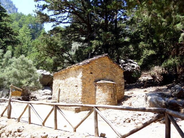
Το Φαράγγι της Σαμαριάς είναι το διασημότερο πεζοπορικό φαράγγι της Ευρώπης, αποτελώντας τμήμα του Ευρωπαϊκού μονοπατιού Ε4. Χιλιάδες τουρίστες το κατεβαίνουν με τα πόδια το καλοκαίρι. Το μήκος του αγγίζει τα 15 χλμ και η κατάβαση του διαρκεί περίπου 5-7 ώρες, ανάλογα το ρυθμό σας, από τον Ομαλό ως την Αγία Ρουμέλη. Βρίσκεται στη νότια πλευρά του Νομού Χανίων. Δημιουργήθηκε από το ποτάμι που ρέει ανάμεσα στον κύριο όγκο των Λευκών Ορέων και το όρος Βολακιάς
Το πιο γνωστό μέρος του φαραγγιού είναι το σημείο γνωστό ως Πόρτες ή Σιδερόπορτες, όπου οι πλευρές του έρχονται σε απόσταση μόλις 4μ., ενώ υψώνονται σε ύψος 500μ.! Το φαράγγι έγινε εθνικός δρυμός το 1962, κυρίως λειτουργώντας ως καταφύγιο για τον απειλούμενο Κρητικό αίγαγρο, ο οποίος περιορίζεται σήμερα στη Σαμαριά, στο νησί Θοδωρού αλλά και σε άλλες νησίδες σε διάφορα μέρη της Ελλάδος. Υπάρχουν πολλά είδη πανίδας και χλωρίδας που ενδημούν στο φαράγγι και τη γύρω περιοχή.
Σκοπός του ταξιδιού στην Κρήτη για πολλούς επισκέπτες της είναι η πεζοπορία μέσα στο φαράγγι για να βγουν στο Νότιο Κρητικό Πέλαγος. Από την Αγία Ρουμέλη οι επισκέπτες παίρνουν το καραβάκι που φεύγει για τη Χώρα Σφακίων και στη συνέχεια το λεωφορείο της επιστροφής για τα Χανιά.
Η πορεία στο φαράγγι διαρκεί 5-7 ώρες και μπορεί να είναι λίγο κουραστική, ιδίως αν δεν ξεκινήσετε πρωί πρωί και σας πιάσει η ζέστη.
517 ντόπιοι το προτείνουν
Samaria Gorge
Το Φαράγγι της Σαμαριάς είναι το διασημότερο πεζοπορικό φαράγγι της Ευρώπης, αποτελώντας τμήμα του Ευρωπαϊκού μονοπατιού Ε4. Χιλιάδες τουρίστες το κατεβαίνουν με τα πόδια το καλοκαίρι. Το μήκος του αγγίζει τα 15 χλμ και η κατάβαση του διαρκεί περίπου 5-7 ώρες, ανάλογα το ρυθμό σας, από τον Ομαλό ως την Αγία Ρουμέλη. Βρίσκεται στη νότια πλευρά του Νομού Χανίων. Δημιουργήθηκε από το ποτάμι που ρέει ανάμεσα στον κύριο όγκο των Λευκών Ορέων και το όρος Βολακιάς
Το πιο γνωστό μέρος του φαραγγιού είναι το σημείο γνωστό ως Πόρτες ή Σιδερόπορτες, όπου οι πλευρές του έρχονται σε απόσταση μόλις 4μ., ενώ υψώνονται σε ύψος 500μ.! Το φαράγγι έγινε εθνικός δρυμός το 1962, κυρίως λειτουργώντας ως καταφύγιο για τον απειλούμενο Κρητικό αίγαγρο, ο οποίος περιορίζεται σήμερα στη Σαμαριά, στο νησί Θοδωρού αλλά και σε άλλες νησίδες σε διάφορα μέρη της Ελλάδος. Υπάρχουν πολλά είδη πανίδας και χλωρίδας που ενδημούν στο φαράγγι και τη γύρω περιοχή.
Σκοπός του ταξιδιού στην Κρήτη για πολλούς επισκέπτες της είναι η πεζοπορία μέσα στο φαράγγι για να βγουν στο Νότιο Κρητικό Πέλαγος. Από την Αγία Ρουμέλη οι επισκέπτες παίρνουν το καραβάκι που φεύγει για τη Χώρα Σφακίων και στη συνέχεια το λεωφορείο της επιστροφής για τα Χανιά.
Η πορεία στο φαράγγι διαρκεί 5-7 ώρες και μπορεί να είναι λίγο κουραστική, ιδίως αν δεν ξεκινήσετε πρωί πρωί και σας πιάσει η ζέστη.
Είναι ένα σημείο μαγικό και καμία φωτογραφία δεν μπορεί να αποδώσει την μεγαλοπρέπειά του.
Τα Σεϊτάν λιμάνια βρίσκονται στην βορειοανατολική πλευρά της χερσονήσου του Ακρωτηρίου στην δυτική Κρήτη, 20 χιλιόμετρα από την πόλη των Χανίων.
Εκεί, λωρίδες θάλασσας εισχωρούν ανάμεσα στις απόκρυμνες βραχώδεις ακτές του Ακρωτηρίου δημιουργώντας μικρούς όρμους. Σε έναν από αυτούς βρίσκεται αυτή η καλά κρυμμένη -και καταραμένη- παραλία.
Η τοποθεσία είναι γνωστή με την ονομασία Σεϊτάν Λιμάνια ή παραλία του Στεφάνου Σεϊτάν. Η λέξη Σεϊτάν είναι τούρκικη, που προφανώς έχει μείνει από την περίοδο της τουρκοκρατίας στην Κρήτη, και μεταφράζεται ως διαβολικός. Επομένως τα Σεϊτάν Λιμάνια μεταφράζονται ως Διαβολολίμανα.
239 ντόπιοι το προτείνουν
Παραλία Σεϊτάν Λιμανιών
Είναι ένα σημείο μαγικό και καμία φωτογραφία δεν μπορεί να αποδώσει την μεγαλοπρέπειά του.
Τα Σεϊτάν λιμάνια βρίσκονται στην βορειοανατολική πλευρά της χερσονήσου του Ακρωτηρίου στην δυτική Κρήτη, 20 χιλιόμετρα από την πόλη των Χανίων.
Εκεί, λωρίδες θάλασσας εισχωρούν ανάμεσα στις απόκρυμνες βραχώδεις ακτές του Ακρωτηρίου δημιουργώντας μικρούς όρμους. Σε έναν από αυτούς βρίσκεται αυτή η καλά κρυμμένη -και καταραμένη- παραλία.
Η τοποθεσία είναι γνωστή με την ονομασία Σεϊτάν Λιμάνια ή παραλία του Στεφάνου Σεϊτάν. Η λέξη Σεϊτάν είναι τούρκικη, που προφανώς έχει μείνει από την περίοδο της τουρκοκρατίας στην Κρήτη, και μεταφράζεται ως διαβολικός. Επομένως τα Σεϊτάν Λιμάνια μεταφράζονται ως Διαβολολίμανα.

Hora Sfakion
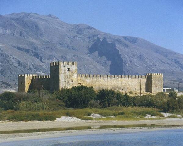
Frangokastello
Παλιό Βενετσιάνικο Λιμάνι
8 Agiou MarkouFAMOUS BEACHES
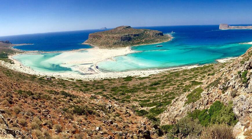
The famous lagoon of Balos is located approximately 56km northwest of Chania and 17km northwest of Kissamos, formed between the Cape Gramvousa and the small Cape Tigani and below the range of Platiskinos. Balos is surely the mostly photographed beach in Crete, a very favorite subject of all tourist guides for Greece.
The lagoon of Balos has white sand and exotic white, vivid blue and turquoise waters. The sea is very shallow and warm, ideal for young children. In many places the sand has a lovely pinkish color, because of millions of crushed shells.
ACCESS
Balos can be accessed in three ways. The first and easiest way is to take the morning ferry from Kissamos (around 25 to 30 Euros). You'll have the chance to see the wild shores of peninsula Gramvousa and the marks from their lifting up for 6-9m after a strong earthquake in 365AD. If you're lucky, you might be accompanied by dolphins. Furthermore, the ferry will leave you for a swim in the exotic beach of Imeri Gramvousa islet, where you will see the old fortress and the wrecked ship.
If you do not want to come by boat and have a car or motorbike, you can drive in the dirt road, starting from Kaliviani and running along the Cape Gramvousa. Near Kaliviani you have to pay a small fee destined for the protection of the Gramvousa Reserve and preservation of the road. After 10km the road stops at a wide parking area, next to a canteen, just over the lagoon. The panoramic view of Balos and the island of the Gramvousa is breathtaking. From there, you can walk down in the 1km longpath leading to the beach or, better, in heaven! Return to the parking area is quite strenuous and tiring due to the inclination.
However, the most exciting way to access Balos is by trekking for three hours from Kaliviani, crossing the rough and dry landscape of Gramvousa and the range of Platyskinos. Do not forget to wear a hat and have plenty of water with you. If you come in Balos, you can visit the small chapel of Saint George located in Tigani. At Tigani, you could also visit the large cavern where many women and children were slaughtered during the Turkish massacres in 1825. The Christians were hiding in the cave, but the Turks soon discovered their shelter, thus killed them all. There is a commemorative sign at the site where the bones of the victims were found. Also, north of Balos, in Cape Korykon there are remains of the small Roman town of Agnio with the temple of Apollo. Today, there is the picturesque chapel of Saint Sozon.
11 ντόπιοι το προτείνουν
Balos Beach
The famous lagoon of Balos is located approximately 56km northwest of Chania and 17km northwest of Kissamos, formed between the Cape Gramvousa and the small Cape Tigani and below the range of Platiskinos. Balos is surely the mostly photographed beach in Crete, a very favorite subject of all tourist guides for Greece.
The lagoon of Balos has white sand and exotic white, vivid blue and turquoise waters. The sea is very shallow and warm, ideal for young children. In many places the sand has a lovely pinkish color, because of millions of crushed shells.
ACCESS
Balos can be accessed in three ways. The first and easiest way is to take the morning ferry from Kissamos (around 25 to 30 Euros). You'll have the chance to see the wild shores of peninsula Gramvousa and the marks from their lifting up for 6-9m after a strong earthquake in 365AD. If you're lucky, you might be accompanied by dolphins. Furthermore, the ferry will leave you for a swim in the exotic beach of Imeri Gramvousa islet, where you will see the old fortress and the wrecked ship.
If you do not want to come by boat and have a car or motorbike, you can drive in the dirt road, starting from Kaliviani and running along the Cape Gramvousa. Near Kaliviani you have to pay a small fee destined for the protection of the Gramvousa Reserve and preservation of the road. After 10km the road stops at a wide parking area, next to a canteen, just over the lagoon. The panoramic view of Balos and the island of the Gramvousa is breathtaking. From there, you can walk down in the 1km longpath leading to the beach or, better, in heaven! Return to the parking area is quite strenuous and tiring due to the inclination.
However, the most exciting way to access Balos is by trekking for three hours from Kaliviani, crossing the rough and dry landscape of Gramvousa and the range of Platyskinos. Do not forget to wear a hat and have plenty of water with you. If you come in Balos, you can visit the small chapel of Saint George located in Tigani. At Tigani, you could also visit the large cavern where many women and children were slaughtered during the Turkish massacres in 1825. The Christians were hiding in the cave, but the Turks soon discovered their shelter, thus killed them all. There is a commemorative sign at the site where the bones of the victims were found. Also, north of Balos, in Cape Korykon there are remains of the small Roman town of Agnio with the temple of Apollo. Today, there is the picturesque chapel of Saint Sozon.
Famous beaches
Τhe exotic beach of Falassarna is located 59km west of Chania city and almost 17km west of Kissamos, at the western base of peninsula Gramvousa. At the northern end of the beach there are the ruins of the ancient Grecoroman city of Phalassarna.
Falassarna bay hosts some of the most famous beaches in Greece, which has been awarded as the best beach of Crete and voted as one of the 10 best beaches in Europe several times in the past. Falasarna spans a large area and consists actually of five consecutive beaches, with the two most central being the most favorite.
The sand in Falassarna is whitish, making the water color tropical. Indeed, if you're lucky and be here on a day that is not blowing from the west (rare in west Crete) you will be enchanted by the beach and its turquoise waters.
The main beach of Falassarna is called Pachia Ammos (i..e Coarse Sand). It is an exotic beach with a length of 1km and a width of 150m. This beach attracts the most visitors of the area, but because of its length it never seems too crowded. The beach offers umbrellas and a few snack bars and cafes, where you can get food and water. There are also services for water sports and beach volley courts.
There is another long beach north of the main beach having a length of 800m, identical to the main beach, which is separated into several smaller beaches. This bay is divided in half by a sand dune and a few rocks. The beach is more quiet than Pachia Ammos and offers no facilities. Nearby, there is the chapel of Agia Paraskevi and a spring with fresh water.
337 ντόπιοι το προτείνουν
Παραλία Φαλάσαρνα
Τhe exotic beach of Falassarna is located 59km west of Chania city and almost 17km west of Kissamos, at the western base of peninsula Gramvousa. At the northern end of the beach there are the ruins of the ancient Grecoroman city of Phalassarna.
Falassarna bay hosts some of the most famous beaches in Greece, which has been awarded as the best beach of Crete and voted as one of the 10 best beaches in Europe several times in the past. Falasarna spans a large area and consists actually of five consecutive beaches, with the two most central being the most favorite.
The sand in Falassarna is whitish, making the water color tropical. Indeed, if you're lucky and be here on a day that is not blowing from the west (rare in west Crete) you will be enchanted by the beach and its turquoise waters.
The main beach of Falassarna is called Pachia Ammos (i..e Coarse Sand). It is an exotic beach with a length of 1km and a width of 150m. This beach attracts the most visitors of the area, but because of its length it never seems too crowded. The beach offers umbrellas and a few snack bars and cafes, where you can get food and water. There are also services for water sports and beach volley courts.
There is another long beach north of the main beach having a length of 800m, identical to the main beach, which is separated into several smaller beaches. This bay is divided in half by a sand dune and a few rocks. The beach is more quiet than Pachia Ammos and offers no facilities. Nearby, there is the chapel of Agia Paraskevi and a spring with fresh water.
Stavros (i.e. cross) is a seaside village located 17km northeast of Chania, at the northernmost edge of Cape Akrotiri. One characteristic feature of the area is the very steep camel-shaped mountain Vardies rising opposite the harbor of Stavros. The mountain is famous, because there were filmed scenes for the film “Zorba the Greek”, where Anthony Quinn danced the famous Sirtaki Dance in 1964. Then Stavros was a humble small fishing village. Today the region has become a major tourist resort with many hotels and important tourist infrastructures. The two beautiful beaches of the area have contributed to the development of the area.
The main beach is located east of the village, at the foot of the mountain Vardies, and next to the picturesque harbor. A semicircular lagoon is formed, fully protected by winds blowing in the region. The small bay has marvelous white sand and shallow turquoise water. The contrast of the wild mountain with the peaceful beach in the foreground makes Stavros a unique place for swimming. As expected, the beach is very well organized and provides all possible services. The second beach of Stavros is located north of the village, 200m northwest of the main beach. It has sand and rocks in places and is less organized than the first, but cleaner. The main drawback of this is that it is unprotected and the sea is usually wavy. At the peninsula dividing the two beaches of Stavros, you can see the remains of the ancient quarry, used for extracting limestone for building the Walls of Chania during the Venetian Era (13rd- 17th century).
In Stavros you will find many more options rather than restaurants, such as mini markets, shops, cafes etc. Moreover, there are bus services from Chania city.
125 ντόπιοι το προτείνουν
Παραλία Σταυρός
Stavros (i.e. cross) is a seaside village located 17km northeast of Chania, at the northernmost edge of Cape Akrotiri. One characteristic feature of the area is the very steep camel-shaped mountain Vardies rising opposite the harbor of Stavros. The mountain is famous, because there were filmed scenes for the film “Zorba the Greek”, where Anthony Quinn danced the famous Sirtaki Dance in 1964. Then Stavros was a humble small fishing village. Today the region has become a major tourist resort with many hotels and important tourist infrastructures. The two beautiful beaches of the area have contributed to the development of the area.
The main beach is located east of the village, at the foot of the mountain Vardies, and next to the picturesque harbor. A semicircular lagoon is formed, fully protected by winds blowing in the region. The small bay has marvelous white sand and shallow turquoise water. The contrast of the wild mountain with the peaceful beach in the foreground makes Stavros a unique place for swimming. As expected, the beach is very well organized and provides all possible services. The second beach of Stavros is located north of the village, 200m northwest of the main beach. It has sand and rocks in places and is less organized than the first, but cleaner. The main drawback of this is that it is unprotected and the sea is usually wavy. At the peninsula dividing the two beaches of Stavros, you can see the remains of the ancient quarry, used for extracting limestone for building the Walls of Chania during the Venetian Era (13rd- 17th century).
In Stavros you will find many more options rather than restaurants, such as mini markets, shops, cafes etc. Moreover, there are bus services from Chania city.
Γειτονιές
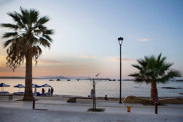
Nea Chora is a long sandy beach, located 1km west of Chania city center, along the Akti Papanikoli Street and opposite Lazaretta islet. You can walk to here from Chania old harbor, since it takes around 15 minutes. The main beach of Nea Chora is very well organized, with several amenities nearby. It is a nice sandy beach, with rocks in some places. Nea Chora is ideal for those that do not want to leave the city centre. Beyond the east side of the beach, there is the old soap factory (you can still see it's high chimney) and the old sanatorium of Chania. Nea Chora is popular to locals for it's fish taverns. Of course, there are many taverns, restaurants, snack bars and cafes in the area. The "Sardine Festival" is organized every summer at the beach of Nea Chora, with traditional music, dances and free fish for the visitors.
18 ντόπιοι το προτείνουν
Nea Chora
Nea Chora is a long sandy beach, located 1km west of Chania city center, along the Akti Papanikoli Street and opposite Lazaretta islet. You can walk to here from Chania old harbor, since it takes around 15 minutes. The main beach of Nea Chora is very well organized, with several amenities nearby. It is a nice sandy beach, with rocks in some places. Nea Chora is ideal for those that do not want to leave the city centre. Beyond the east side of the beach, there is the old soap factory (you can still see it's high chimney) and the old sanatorium of Chania. Nea Chora is popular to locals for it's fish taverns. Of course, there are many taverns, restaurants, snack bars and cafes in the area. The "Sardine Festival" is organized every summer at the beach of Nea Chora, with traditional music, dances and free fish for the visitors.
ΕΝΔΟΧΩΡΑ
Ο επισκέπτης μπορεί να μεταβεί στη Λίμνη του Κουρνά με το λεωφορείο που εκτελεί το δρομολόγιο Χανιά-Κουρνά. Η λίμνη του Κουρνά είναι η μοναδική λίμνη γλυκού νερού της Κρήτης. Βρίσκεται 47 χλμ. μακριά από τα Χανιά σε μια ειδυλλιακή τοποθεσία, σε ένα κοίλωμα ανάμεσα σε επιβλητικούς λόφους. Η λίμνη είναι ιδανικός προορισμός για έναν απογευματινό περίπατο ή μια κοντινή εκδρομή. Το τοπίο είναι χαλαρωτικό και η λίμνη προσφέρεται για μπάνιο ή θαλάσσιο ποδήλατο. Η ιδιαιτερότητα αυτής της λίμνης είναι ότι ανάλογα με την εποχή αλλάζει χρώματα και μέγεθος όπως ισχυρίζονται οι κάτοικοι.
40 ντόπιοι το προτείνουν
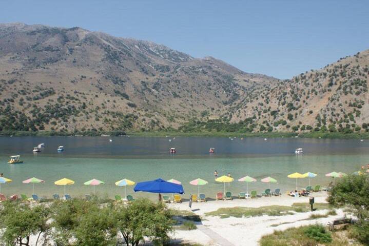
Kournas
Ο επισκέπτης μπορεί να μεταβεί στη Λίμνη του Κουρνά με το λεωφορείο που εκτελεί το δρομολόγιο Χανιά-Κουρνά. Η λίμνη του Κουρνά είναι η μοναδική λίμνη γλυκού νερού της Κρήτης. Βρίσκεται 47 χλμ. μακριά από τα Χανιά σε μια ειδυλλιακή τοποθεσία, σε ένα κοίλωμα ανάμεσα σε επιβλητικούς λόφους. Η λίμνη είναι ιδανικός προορισμός για έναν απογευματινό περίπατο ή μια κοντινή εκδρομή. Το τοπίο είναι χαλαρωτικό και η λίμνη προσφέρεται για μπάνιο ή θαλάσσιο ποδήλατο. Η ιδιαιτερότητα αυτής της λίμνης είναι ότι ανάλογα με την εποχή αλλάζει χρώματα και μέγεθος όπως ισχυρίζονται οι κάτοικοι.
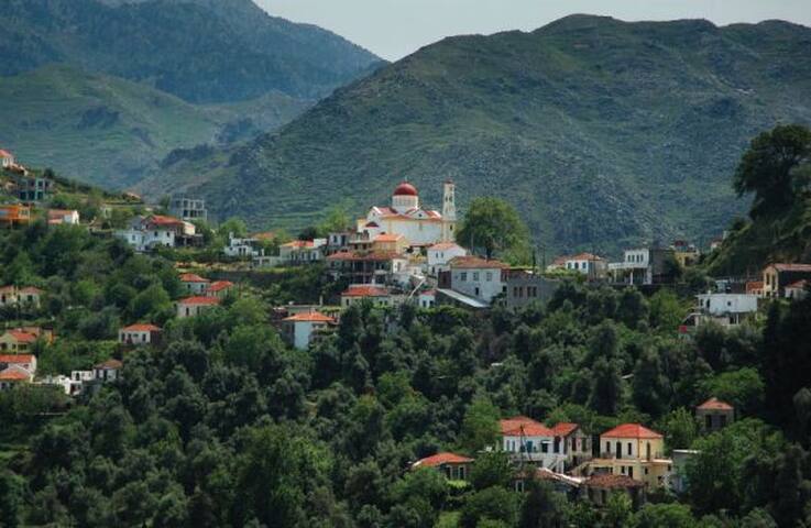
Ο επισκέπτης μπορεί να μεταβεί το γραφικό χωριό της Αργυρούπολης με τα λεωφορεία που εκτελούν τα δρομολόγια Χανιά-Ρέθυμνο και Ρέθυμνο-Αργυρούπολη.
Η Αργυρούπολη είναι ένα ορεινό χωριό νοτιοδυτικά του Ρεθύμνου σε απόσταση 21 χλμ. Είναι ένα γραφικό χωριό πλούσιας φυσικής ομορφιάς και χαρακτηριστικό του είναι τα πολλά αρχαία αρχιτεκτονικά μέλη εντοιχισμένα στα σπίτια. Το χωριό είναι γνωστό και για την ιστορική του σημασία διότι εδώ κηρύχθηκε η ένωση της Κρήτης με την Ελλάδα. Όπως και στα άλλα γραφικά χωριά της ενδοχώρας έτσι και στην Αργυρούπολη ο επισκέπτης απολαμβάνει ένα δροσερό φυσικό περιβάλλον παρέα με παραδοσιακά κρητικά εδέσματα και κρητική φιλοξενία.
16 ντόπιοι το προτείνουν
Argyroupoli
Ο επισκέπτης μπορεί να μεταβεί το γραφικό χωριό της Αργυρούπολης με τα λεωφορεία που εκτελούν τα δρομολόγια Χανιά-Ρέθυμνο και Ρέθυμνο-Αργυρούπολη.
Η Αργυρούπολη είναι ένα ορεινό χωριό νοτιοδυτικά του Ρεθύμνου σε απόσταση 21 χλμ. Είναι ένα γραφικό χωριό πλούσιας φυσικής ομορφιάς και χαρακτηριστικό του είναι τα πολλά αρχαία αρχιτεκτονικά μέλη εντοιχισμένα στα σπίτια. Το χωριό είναι γνωστό και για την ιστορική του σημασία διότι εδώ κηρύχθηκε η ένωση της Κρήτης με την Ελλάδα. Όπως και στα άλλα γραφικά χωριά της ενδοχώρας έτσι και στην Αργυρούπολη ο επισκέπτης απολαμβάνει ένα δροσερό φυσικό περιβάλλον παρέα με παραδοσιακά κρητικά εδέσματα και κρητική φιλοξενία.
Ο επισκέπτης μπορεί να μεταβεί στις Βρύσες με τα λεωφορεία που εκτελούν τα δρομολόγια Χανιά-Ηράκλειο, συγκεκριμένες ώρες, τα οποία περνάνε μέσα από το χωριό.
Οι Βρύσες είναι ένα παραδοσιακό χωριό το οποίο βρίσκεται 30 χλμ νοτιοανατολικά της πόλης των Χανίων. Είναι ένα πανέμορφο χωριό χτισμένο σε μια κοιλάδα γεμάτη από δένδρα, πλούσια βλάστηση και τρεχούμενα νερά. Ο επισκέπτης μπορεί να απολαύσει την ομορφιά της φύσης και να δοκιμάσει την παραδοσιακή κρητική κουζίνα στις ταβέρνες του χωριού. Αξίζει επίσης να επισκεφθεί τα γύρω χωριά όπως τα Φρε, Βαφέ, Εμπρόσνερο, Αλίκαμπο και Μάζα τα οποία διατηρούν ζωντανό τον παραδοσιακό τρόπο ζωής των Κρητικών. Η αυθεντική εικόνα του χωριού και η ιδιαίτερη φιλοξενία των κατοίκων είναι αυτές που αιχμαλωτίζουν τον επισκέπτη.
25 ντόπιοι το προτείνουν
Vryses
Ο επισκέπτης μπορεί να μεταβεί στις Βρύσες με τα λεωφορεία που εκτελούν τα δρομολόγια Χανιά-Ηράκλειο, συγκεκριμένες ώρες, τα οποία περνάνε μέσα από το χωριό.
Οι Βρύσες είναι ένα παραδοσιακό χωριό το οποίο βρίσκεται 30 χλμ νοτιοανατολικά της πόλης των Χανίων. Είναι ένα πανέμορφο χωριό χτισμένο σε μια κοιλάδα γεμάτη από δένδρα, πλούσια βλάστηση και τρεχούμενα νερά. Ο επισκέπτης μπορεί να απολαύσει την ομορφιά της φύσης και να δοκιμάσει την παραδοσιακή κρητική κουζίνα στις ταβέρνες του χωριού. Αξίζει επίσης να επισκεφθεί τα γύρω χωριά όπως τα Φρε, Βαφέ, Εμπρόσνερο, Αλίκαμπο και Μάζα τα οποία διατηρούν ζωντανό τον παραδοσιακό τρόπο ζωής των Κρητικών. Η αυθεντική εικόνα του χωριού και η ιδιαίτερη φιλοξενία των κατοίκων είναι αυτές που αιχμαλωτίζουν τον επισκέπτη.
Ο επισκέπτης μπορεί να μεταβεί στο Θέρισο με το λεωφορείο που εκτελεί το δρομολόγιο Χανιά-Θέρισος.
Ο Θέρισος είναι ένα γραφικό και ιστορικό χωριό, χτισμένο στους πρόποδες των Λευκών Ορέων. Βρίσκεται σε απόσταση 16 χλμ από την πόλη των Χανίων. Αξίζει κανείς να επισκεφθεί το χωριό για να νιώσει την ζεστή φιλοξενία των κατοίκων και να γευτεί την πλούσια παραδοσιακή κρητική κουζίνα στις αμέτρητες ταβέρνες του χωριού. Θα απολαύσει το μαγευτικό φυσικό περιβάλλον και ιδιαίτερα το εντυπωσιακό φαράγγι δίπλα στο ποτάμι που θα διασχίσει στην διαδρομή από τα Χανιά. Η οδήγηση σε αυτό τον δρόμο είναι μια απολαυστική και αξέχαστη εμπειρία για τους επισκέπτες.
74 ντόπιοι το προτείνουν
Theriso
Ο επισκέπτης μπορεί να μεταβεί στο Θέρισο με το λεωφορείο που εκτελεί το δρομολόγιο Χανιά-Θέρισος.
Ο Θέρισος είναι ένα γραφικό και ιστορικό χωριό, χτισμένο στους πρόποδες των Λευκών Ορέων. Βρίσκεται σε απόσταση 16 χλμ από την πόλη των Χανίων. Αξίζει κανείς να επισκεφθεί το χωριό για να νιώσει την ζεστή φιλοξενία των κατοίκων και να γευτεί την πλούσια παραδοσιακή κρητική κουζίνα στις αμέτρητες ταβέρνες του χωριού. Θα απολαύσει το μαγευτικό φυσικό περιβάλλον και ιδιαίτερα το εντυπωσιακό φαράγγι δίπλα στο ποτάμι που θα διασχίσει στην διαδρομή από τα Χανιά. Η οδήγηση σε αυτό τον δρόμο είναι μια απολαυστική και αξέχαστη εμπειρία για τους επισκέπτες.
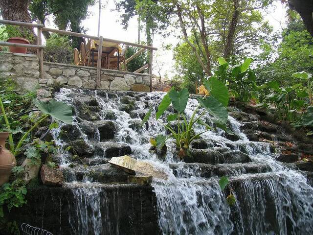
Διασκέδαση
Koukouvaya
Διασκέδαση
Ο επισκέπτης μπορεί να μεταβεί στη Λιμνούπολη με το λεωφορείο που εκτελεί το δρομολόγιο Χανιά-Λιμνούπολη.
To Υδροψυχαγωγικό Πάρκο Λιμνούπολη βρίσκεται 8 χλμ. από την πόλη των Χανίων. Βρίσκεται σε μια καταπράσινη έκταση γεμάτη συναρπαστικά νεροπαιχνίδια. Στα αμέτρητα παιχνίδια μπορούν να διασκεδάσουν μικροί και μεγάλοι με τις ώρες και στη συνέχεια να χαλαρώσουν στην καφετέρια και το εστιατόριο.
141 ντόπιοι το προτείνουν
Limnoupolis
Ο επισκέπτης μπορεί να μεταβεί στη Λιμνούπολη με το λεωφορείο που εκτελεί το δρομολόγιο Χανιά-Λιμνούπολη.
To Υδροψυχαγωγικό Πάρκο Λιμνούπολη βρίσκεται 8 χλμ. από την πόλη των Χανίων. Βρίσκεται σε μια καταπράσινη έκταση γεμάτη συναρπαστικά νεροπαιχνίδια. Στα αμέτρητα παιχνίδια μπορούν να διασκεδάσουν μικροί και μεγάλοι με τις ώρες και στη συνέχεια να χαλαρώσουν στην καφετέρια και το εστιατόριο.
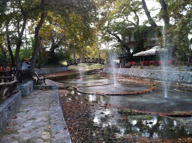
Neromilos
183 PEO Kissamou ChanionNAMA
19 Akti Tompazi