
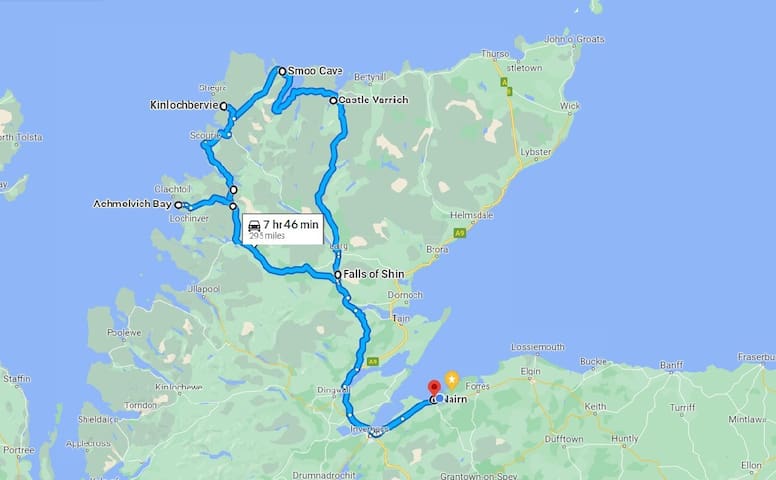
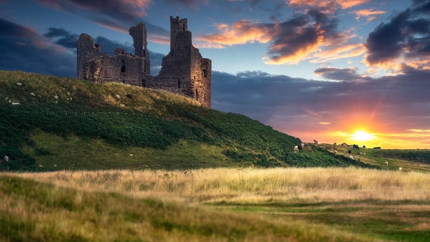
NC500 and other daytrips
Route #1
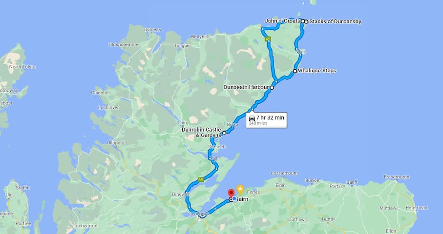
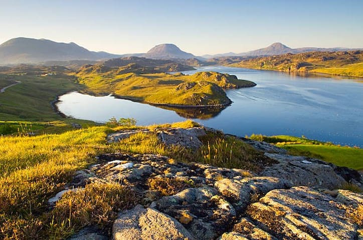
Scottish Highlands
A map of the suggested route
A walk along the pebble beach opposite the harbour provides stunning views of Dunbeath Castle, precariously perched on the ragged clifftops, and the opportunity to catch a glimpse of the wreck site of the SS Gretafield, an oil tanker that was torpedoed off Wick during the second World War and came to rest in the Bay.
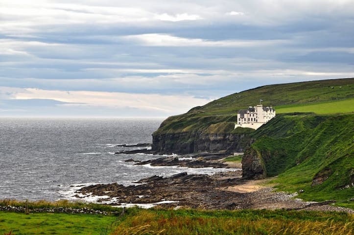
Dunbeath Harbour
Portormin RoadA walk along the pebble beach opposite the harbour provides stunning views of Dunbeath Castle, precariously perched on the ragged clifftops, and the opportunity to catch a glimpse of the wreck site of the SS Gretafield, an oil tanker that was torpedoed off Wick during the second World War and came to rest in the Bay.
Dunrobin Castle is the most northerly of Scotland's great houses and the largest in the Northern Highlands with 189 rooms. It was home to the Earls and later, the Dukes of Sutherland.
80 ντόπιοι το προτείνουν

Κάστρο Ντάνρομπιν
Dunrobin Castle is the most northerly of Scotland's great houses and the largest in the Northern Highlands with 189 rooms. It was home to the Earls and later, the Dukes of Sutherland.
The Whaligoe Steps descend to what was a naturally formed harbour between two sea cliffs, built by Captain David Brodie.
34 ντόπιοι το προτείνουν
Whaligoe Steps
The Whaligoe Steps descend to what was a naturally formed harbour between two sea cliffs, built by Captain David Brodie.
John o' Groats is known for being the endpoint of the furthest distance between two points on the British mainland, the other one being Land's End in Cornwall, 876 miles away.
45 ντόπιοι το προτείνουν
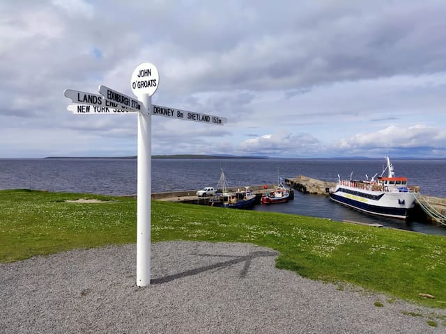
John o' Groats
John o' Groats is known for being the endpoint of the furthest distance between two points on the British mainland, the other one being Land's End in Cornwall, 876 miles away.
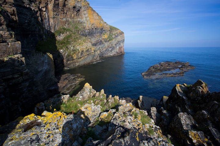
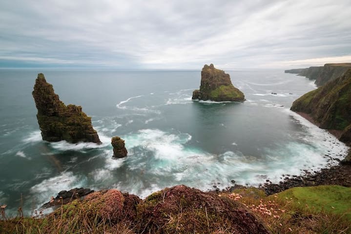
The Duncansby Stacks lie just off the shore of Duncansby Head on the most northeastern point of mainland Britain. These towering sea stacks are believed to have stood in this position for the last 6000 years, slowly eroding away due to the raw power of the North Sea.
13 ντόπιοι το προτείνουν
Duncansby Stacks
The Duncansby Stacks lie just off the shore of Duncansby Head on the most northeastern point of mainland Britain. These towering sea stacks are believed to have stood in this position for the last 6000 years, slowly eroding away due to the raw power of the North Sea.
Route #2
Scottish Highlands
A map of the suggested route
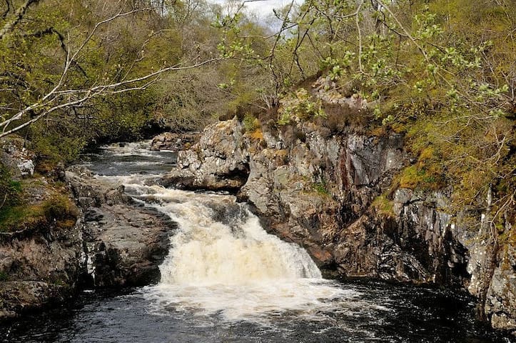
The Falls of Shin visitor attraction is famous for being one of the best places in Scotland to view salmon leaping upstream.
27 ντόπιοι το προτείνουν
Falls of Shin
The Falls of Shin visitor attraction is famous for being one of the best places in Scotland to view salmon leaping upstream.
Castle Bharrich is in the far north of the Scottish Highlands, near the village of Tongue. The castle is on a local high point of rock, overlooking both the Kyle of Tongue and the village of Tongue.
7 ντόπιοι το προτείνουν
Castle Bharrich
Castle Bharrich is in the far north of the Scottish Highlands, near the village of Tongue. The castle is on a local high point of rock, overlooking both the Kyle of Tongue and the village of Tongue.
Smoo Cave is a natural sea cave located ~1 mile to the East of Durness village centre which is in Sutherland in the North West Highlands of Scotland.
34 ντόπιοι το προτείνουν
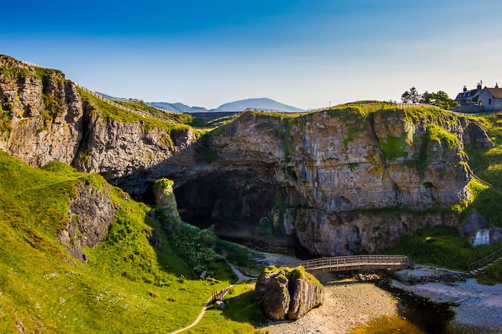
Σπήλαιο Smoo
SmooSmoo Cave is a natural sea cave located ~1 mile to the East of Durness village centre which is in Sutherland in the North West Highlands of Scotland.
Kinlochbervie is a scattered harbour village in the north west of Sutherland, in the Highland region of Scotland. It is the most northerly port on the west coast of Scotland.
Kinlochbervie
Kinlochbervie is a scattered harbour village in the north west of Sutherland, in the Highland region of Scotland. It is the most northerly port on the west coast of Scotland.
The Wailing Widow Falls is a spectacular waterfall in the Scottish Highlands that can be viewed from both above and below. The 50ft falls spill out over the cliff from Loch na Gainmhich, crashing into a narrow canyon at the bottom.
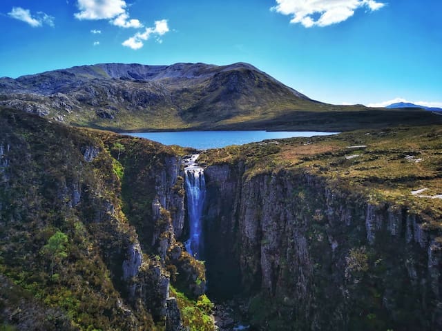
Loch na Gainmhich
The Wailing Widow Falls is a spectacular waterfall in the Scottish Highlands that can be viewed from both above and below. The 50ft falls spill out over the cliff from Loch na Gainmhich, crashing into a narrow canyon at the bottom.
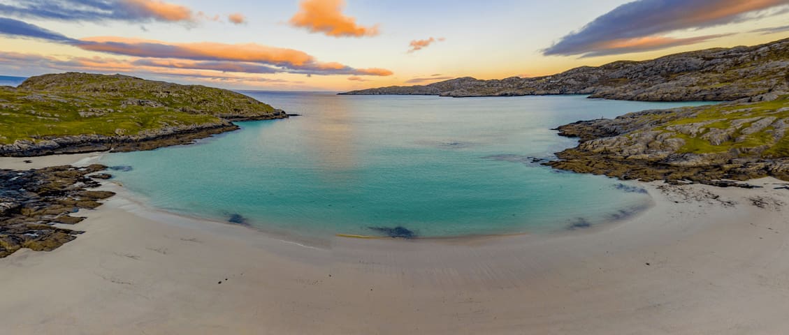
Achmelvich Beach is a stunning, white sandy beach with a popular caravan and camping spot nearby.
15 ντόπιοι το προτείνουν
Achmelvich Beach Car Park
Achmelvich Beach is a stunning, white sandy beach with a popular caravan and camping spot nearby.
Ardvreck Castle is a ruined castle dating to about 1490 when the lands were owned by the Macleods of Assynt. It stands on a rocky promontory jutting out into Loch Assynt in Sutherland, Scotland.
10 ντόπιοι το προτείνουν
Ardvreck Castle station
Ardvreck Castle is a ruined castle dating to about 1490 when the lands were owned by the Macleods of Assynt. It stands on a rocky promontory jutting out into Loch Assynt in Sutherland, Scotland.
Route #3
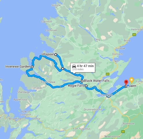
Scottish Highlands
A map of the suggested route
This short but very popular walk descends through varied forestry down to the Blackwater River to visit the impressive Rogie Falls.
49 ντόπιοι το προτείνουν
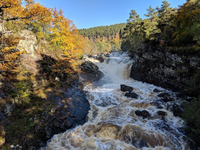
Καταρράκτες Ρόγκι
A835This short but very popular walk descends through varied forestry down to the Blackwater River to visit the impressive Rogie Falls.
Just off the A835 it this picturesque spot featuring the Black Water Falls and Silverbridge, an old stone bridge over the water which you can walk down to and underneath.
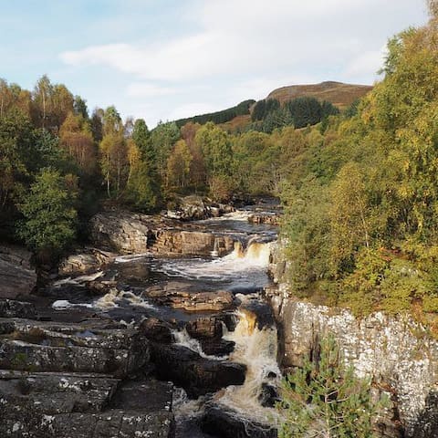
Black Water Falls
Just off the A835 it this picturesque spot featuring the Black Water Falls and Silverbridge, an old stone bridge over the water which you can walk down to and underneath.
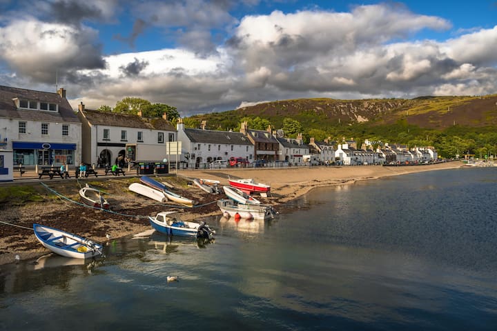
This pretty port on the shores of Loch Broom is the largest settlement in Wester Ross and one of the most alluring spots in the Highlands, a wonderful destination in itself as well as a gateway to the Western Isles. Offering a row of whitewashed cottages arrayed along the harbour and special views of the loch and its flanking hills, the town has a very distinctive appeal.
52 ντόπιοι το προτείνουν
Ullapool
This pretty port on the shores of Loch Broom is the largest settlement in Wester Ross and one of the most alluring spots in the Highlands, a wonderful destination in itself as well as a gateway to the Western Isles. Offering a row of whitewashed cottages arrayed along the harbour and special views of the loch and its flanking hills, the town has a very distinctive appeal.
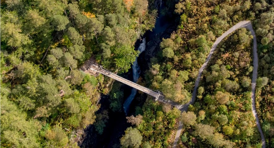
The Corrieshalloch Gorge was formed towards the end of the last ice age when the glacier that formed Loch Broom started to melt and large volumes of water flowed beneath the base of the glacier, carving out the rock below.
Corrieshalloch Gorge station
The Corrieshalloch Gorge was formed towards the end of the last ice age when the glacier that formed Loch Broom started to melt and large volumes of water flowed beneath the base of the glacier, carving out the rock below.
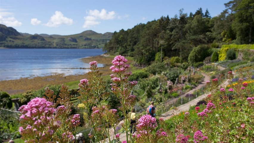
Inverewe Garden is a botanical garden in the Scottish Highlands. It is located just to the north of Poolewe in Wester Ross, and is noted for the breadth of its collection.
16 ντόπιοι το προτείνουν
Κήπος Inverewe
Inverewe Garden is a botanical garden in the Scottish Highlands. It is located just to the north of Poolewe in Wester Ross, and is noted for the breadth of its collection.
Route #4
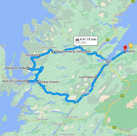
Scottish Highlands
A map of the suggested route
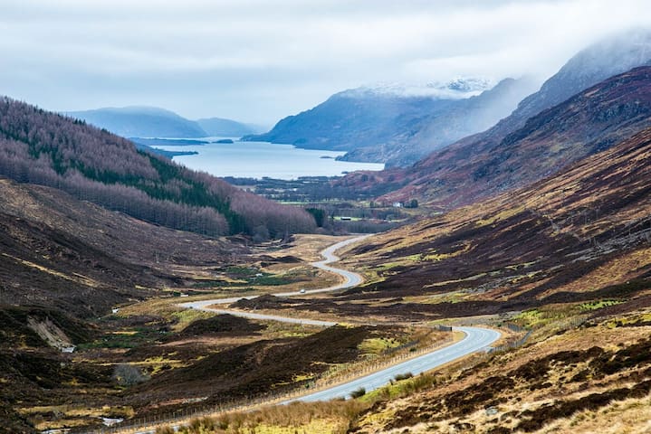
This view point offers one of the most iconic views in the Highlands. Looking down Glen Docherty you will get your first sighting of Letterewe Estate and Loch Maree.
Glen Docherty Viewpoint
This view point offers one of the most iconic views in the Highlands. Looking down Glen Docherty you will get your first sighting of Letterewe Estate and Loch Maree.
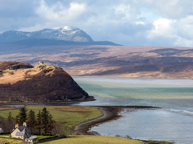
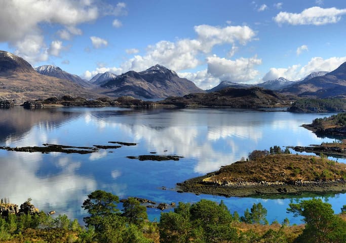
Torridon has a dramatic and desolate setting beneath the mountains, on the shore of Upper Loch Torridon in Wester Ross.
Situated on a scenic minor road that winds along the northern shore of Upper Loch Torridon climbing and twisting past lochans, cliffs, gorges, and green wooded slopes, the town is a good base for exploring the neighbouring countryside. The area is packed full of great walking paths.
17 ντόπιοι το προτείνουν
Torridon
Torridon has a dramatic and desolate setting beneath the mountains, on the shore of Upper Loch Torridon in Wester Ross.
Situated on a scenic minor road that winds along the northern shore of Upper Loch Torridon climbing and twisting past lochans, cliffs, gorges, and green wooded slopes, the town is a good base for exploring the neighbouring countryside. The area is packed full of great walking paths.
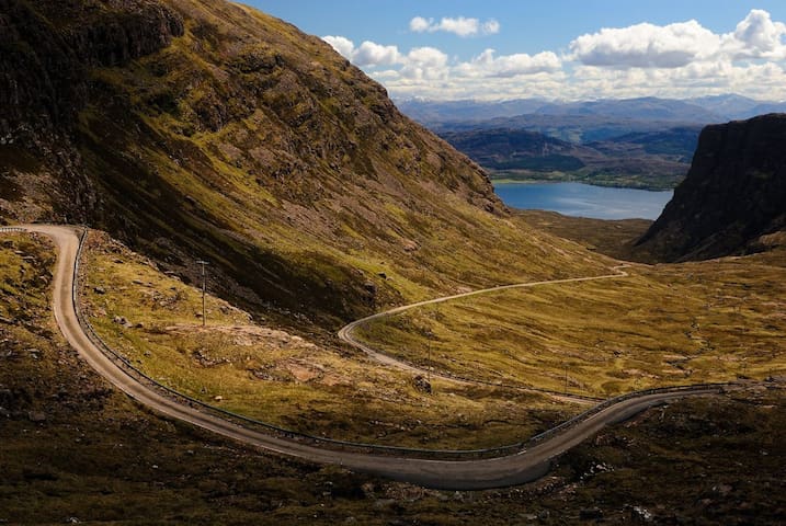
This route winds through stunning Scottish scenery. Crags blanketed in grass loom on either side like daunting roadside guardians. With its sharp curves and coils, it almost looks like a giant asphalt snake slithering through the Highlands.
7 ντόπιοι το προτείνουν
Bealach na Bà
This route winds through stunning Scottish scenery. Crags blanketed in grass loom on either side like daunting roadside guardians. With its sharp curves and coils, it almost looks like a giant asphalt snake slithering through the Highlands.
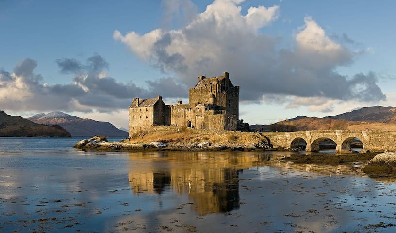
Eilean Donan is probably the most photographed fortress in the whole of Scotland, and has featured in movies such as James Bond (as the Scottish HQ of MI6, no less). The castle guards a small island, deep in the Scottish highlands, at intersection of three tidal lochs.
40 ντόπιοι το προτείνουν
Eilean Donan
Eilean Donan is probably the most photographed fortress in the whole of Scotland, and has featured in movies such as James Bond (as the Scottish HQ of MI6, no less). The castle guards a small island, deep in the Scottish highlands, at intersection of three tidal lochs.
Loch Ness is a large freshwater loch in the Scottish Highlands extending for approximately 37 kilometres southwest of Inverness. It takes its name from the River Ness, which flows from the northern end. Loch Ness is the second-largest Scottish loch by surface area and the largest by volume in the British Isles.
277 ντόπιοι το προτείνουν

Λοχ Νες
Loch Ness is a large freshwater loch in the Scottish Highlands extending for approximately 37 kilometres southwest of Inverness. It takes its name from the River Ness, which flows from the northern end. Loch Ness is the second-largest Scottish loch by surface area and the largest by volume in the British Isles.