
Blue Tongue Berries Local Guidebook
Nature Walks & Scenery
Welcome to Taungurung Country!
Please head to our Blue Tongue Berries website for the latest version of our Local Guidebook. We hope you enjoy our beautiful region.
Nick and Cynthia
Please head to our Blue Tongue Berries website for the latest version of our Local Guidebook.
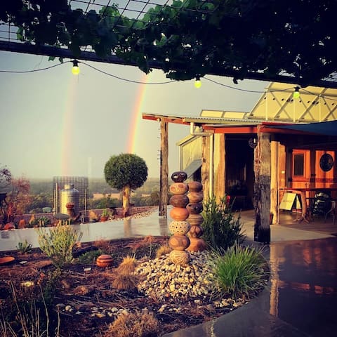
Welcome to Blue Tongue Berries!
Our guests are invited to take a walk around the blueberry farm. We suggest you put on some sturdy walking shoes. Please leave any gates you go through as you find them. Enjoy our stunning 360 degree views and sunsets, we never tire of them, even after 20 years of living here!
We hope you enjoy your stay on our little farm.
Nick and Cynthia
SELF GUIDED FARM TOUR
Find your thrill on blueberry hill. Starting at the carpark area, walk into the courtyard between the strawbale Hacienda and Cantina to see what’s in flower in the garden, then follow the deck past the great stone wall to the lookout deck.
From here, walk to Rancho Ridge at the very top of the hill near the water tanks for the mightiest view in Seymour. Here you can spot Mt Puckapunyal, Mt Piper and the Tallarook Ranges. You will also notice the interesting "rice-paddy-like" terracing of our blueberry rows.
Heading back down the hill, take a rest on the big timber slab seats on top of the underground cellar while admiring the birdlife. Spot the kangaroos boxing at dawn and at dusk.
Go back to the lookout deck then take a stroll down to the blueberry orchard under the big net and munch on ripe berries in spring and summer. Take a gander at the geese, then check out what's in season in the veggie patch. The chickens will expect you to stop for a chat. Did you spot the beehive?
Head down to the dam near the Pickers Shack, then look up! You’ll see the view to the hill top tanks where you started. Keep an eye out for our frolicking Damara sheep around the property and near the barn at the bottom entry gate. From here follow the gravel road behind the dam back up the hill to the carpark.
Grab a drink from the Cantina then pull up a chair in the courtyard and get ready for another glorious sunset.
We've recently hosted One Hour Out Melbourne at our venue and love the write up they gave us. Take a look HERE.
THE CANTINA
Along with our licensed bar, we have all things blueberry for sale in our Cantina. Fresh & frozen berries, jam, chutney and our famous blueberry, coconut & desert lime ice cream. Lunch and blueberry tarts are available during the fresh blueberry season (Dec/Jan) and breakfast is served all year round to our farmstay guests.
Blue Tongue Berries
445 Northwood RdPlease head to our Blue Tongue Berries website for the latest version of our Local Guidebook.
Welcome to Blue Tongue Berries!
Our guests are invited to take a walk around the blueberry farm. We suggest you put on some sturdy walking shoes. Please leave any gates you go through as you find them. Enjoy our stunning 360 degree views and sunsets, we never tire of them, even after 20 years of living here!
We hope you enjoy your stay on our little farm.
Nick and Cynthia
SELF GUIDED FARM TOUR
Find your thrill on blueberry hill. Starting at the carpark area, walk into the courtyard between the strawbale Hacienda and Cantina to see what’s in flower in the garden, then follow the deck past the great stone wall to the lookout deck.
From here, walk to Rancho Ridge at the very top of the hill near the water tanks for the mightiest view in Seymour. Here you can spot Mt Puckapunyal, Mt Piper and the Tallarook Ranges. You will also notice the interesting "rice-paddy-like" terracing of our blueberry rows.
Heading back down the hill, take a rest on the big timber slab seats on top of the underground cellar while admiring the birdlife. Spot the kangaroos boxing at dawn and at dusk.
Go back to the lookout deck then take a stroll down to the blueberry orchard under the big net and munch on ripe berries in spring and summer. Take a gander at the geese, then check out what's in season in the veggie patch. The chickens will expect you to stop for a chat. Did you spot the beehive?
Head down to the dam near the Pickers Shack, then look up! You’ll see the view to the hill top tanks where you started. Keep an eye out for our frolicking Damara sheep around the property and near the barn at the bottom entry gate. From here follow the gravel road behind the dam back up the hill to the carpark.
Grab a drink from the Cantina then pull up a chair in the courtyard and get ready for another glorious sunset.
We've recently hosted One Hour Out Melbourne at our venue and love the write up they gave us. Take a look HERE.
THE CANTINA
Along with our licensed bar, we have all things blueberry for sale in our Cantina. Fresh & frozen berries, jam, chutney and our famous blueberry, coconut & desert lime ice cream. Lunch and blueberry tarts are available during the fresh blueberry season (Dec/Jan) and breakfast is served all year round to our farmstay guests.
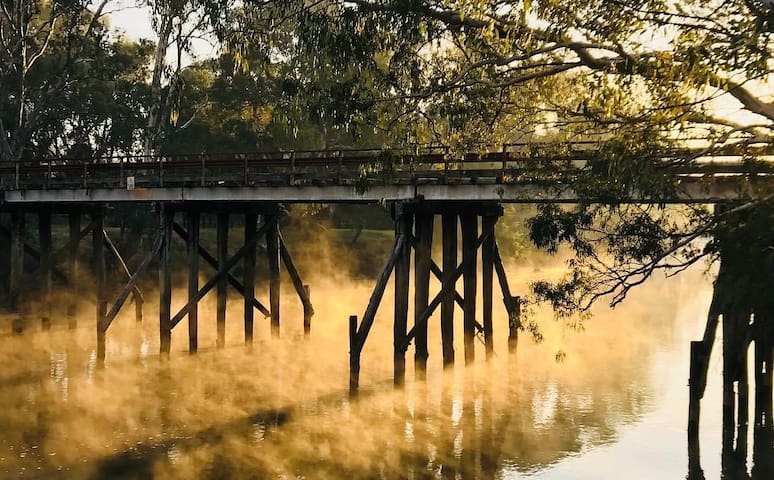
Walk the Goulburn River: The river walk in Seymour meanders along the length of Emily st and is a hidden gem. An easy to walk or ride with under magnificent large gum trees with lots of seating along the way and great for picnics at Lions Park or grab a burger from Burger Me and later a beer at the Royal Hotel or the Prince of Wales. There are interpretative and historic markers and information along the path. Look out for the new canoe scar tree in the car park near the boat ramp. Approximately 3km, depending on where you start. We recommend starting at the Somerset Winery Kitchen end at the old bridge.
https://www.creativespirits.info/aboriginalculture/land/aboriginal-scarred-trees
The Old Goulburn River Bridge, Seymour is of historic, scientific (technological) and aesthetic significance to the State of Victoria.
The bridge spans the crossing place of the Goulburn River on the historic Sydney Road, in use since a Victorian Government punt began operating at the site in 1853.
The Old Goulburn River Bridge is of historic significance for its association with one of Victoria's most important river crossings from 1853 until the diverting of the Hume Highway in 1966.
The Old Goulburn River Bridge is of historical significance in representing two major phases of road bridge construction in Victoria, being the last of the extravagant large timber road bridges of the 19th century and the oldest and most authentic surviving example of a large composite highway bridge of the new motor-vehicle pattern introduced by the Country Roads Board during the Great Depression era.
https://vhd.heritagecouncil.vic.gov.au/places/6157
Manners Street
Manners StreetWalk the Goulburn River: The river walk in Seymour meanders along the length of Emily st and is a hidden gem. An easy to walk or ride with under magnificent large gum trees with lots of seating along the way and great for picnics at Lions Park or grab a burger from Burger Me and later a beer at the Royal Hotel or the Prince of Wales. There are interpretative and historic markers and information along the path. Look out for the new canoe scar tree in the car park near the boat ramp. Approximately 3km, depending on where you start. We recommend starting at the Somerset Winery Kitchen end at the old bridge.
https://www.creativespirits.info/aboriginalculture/land/aboriginal-scarred-trees
The Old Goulburn River Bridge, Seymour is of historic, scientific (technological) and aesthetic significance to the State of Victoria.
The bridge spans the crossing place of the Goulburn River on the historic Sydney Road, in use since a Victorian Government punt began operating at the site in 1853.
The Old Goulburn River Bridge is of historic significance for its association with one of Victoria's most important river crossings from 1853 until the diverting of the Hume Highway in 1966.
The Old Goulburn River Bridge is of historical significance in representing two major phases of road bridge construction in Victoria, being the last of the extravagant large timber road bridges of the 19th century and the oldest and most authentic surviving example of a large composite highway bridge of the new motor-vehicle pattern introduced by the Country Roads Board during the Great Depression era.
https://vhd.heritagecouncil.vic.gov.au/places/6157
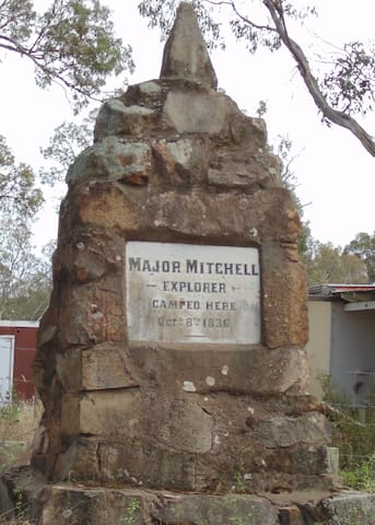
A stopover along the Goulburn River, just like Major Mitchell did in 1836. Great spot for a swim or a paddle.
Here is a great spot for travellers heading along the Hume or along the Goulburn Highways in the central area of Victoria, and with a bit of history thrown in as well. This was the site where Thomas Mitchell crossed the Goulburn on his way back to Sydney after his 1836 winter tour of Australia Felix, more commonly called Victoria nowadays. It is just 20-25 kilometres north of the Hume along the Goulburn Highway then duck left a few kilometres towards the Goulburn River at Mitchellstown.
Source: https://ontheroadmagazine.com.au/majors-creek-reserve-mitchellstown/
Majors Creek
A stopover along the Goulburn River, just like Major Mitchell did in 1836. Great spot for a swim or a paddle.
Here is a great spot for travellers heading along the Hume or along the Goulburn Highways in the central area of Victoria, and with a bit of history thrown in as well. This was the site where Thomas Mitchell crossed the Goulburn on his way back to Sydney after his 1836 winter tour of Australia Felix, more commonly called Victoria nowadays. It is just 20-25 kilometres north of the Hume along the Goulburn Highway then duck left a few kilometres towards the Goulburn River at Mitchellstown.
Source: https://ontheroadmagazine.com.au/majors-creek-reserve-mitchellstown/
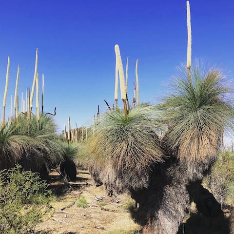
The Tallarook State Forest is a fantastic spot to enjoy a wide range of recreational activities including, four-wheel driving, bushwalking, trail bike riding, camping, fishing, mountain bike riding and horse riding.
Stay at one of the many campsites throughout the forest such as Flat Rock, Trawool Reservoir Camp and Tassie Camp. If you don’t feel like getting completely back to nature, Freemans Camp offers toilet facilities, picnic tables and barbeques.
Popular sightseeing areas include the Trawool Reservoir and Mt Hickey. Don’t forget to also pay a visit to the nearby Mt Disappointment State Forest.
Content: Seymour Visitor Information Centre
Source: https://www.visitvictoria.com/regions/daylesford-and-the-macedon-ranges/things-to-do/nature-and-wildlife/national-parks-and-reserves/tallarook-state-forest
Tallarook State Forest
Main RoadThe Tallarook State Forest is a fantastic spot to enjoy a wide range of recreational activities including, four-wheel driving, bushwalking, trail bike riding, camping, fishing, mountain bike riding and horse riding.
Stay at one of the many campsites throughout the forest such as Flat Rock, Trawool Reservoir Camp and Tassie Camp. If you don’t feel like getting completely back to nature, Freemans Camp offers toilet facilities, picnic tables and barbeques.
Popular sightseeing areas include the Trawool Reservoir and Mt Hickey. Don’t forget to also pay a visit to the nearby Mt Disappointment State Forest.
The Tallarook State Forest is a fantastic spot to enjoy a wide range of recreational activities including, four-wheel driving, bushwalking, trail bike riding, camping, fishing, mountain bike riding and horse riding.
Stay at one of the many campsites throughout the forest such as Flat Rock, Trawool Reservoir Camp and Tassie Camp. If you don’t feel like getting completely back to nature, Freemans Camp offers toilet facilities, picnic tables and barbeques.
Popular sightseeing areas include the Trawool Reservoir and Mt Hickey. Don’t forget to also pay a visit to the nearby Mt Disappointment State Forest.
Content: Seymour Visitor Information Centre
Source: https://www.visitvictoria.com/regions/daylesford-and-the-macedon-ranges/things-to-do/nature-and-wildlife/national-parks-and-reserves/tallarook-state-forest
The Australian Light Horse Memorial Park in Seymour, is situated in a very beautiful rural environment, just across the Great Dividing Range and only 105 kms from Melbourne. The park is readily accessed from the nearby Hume Freeway, and the Goulburn Valley Highway. It is also accessible by train on the State's main North East rail line.
Just one kilometre along the Goulburn Valley Highway on the Eastern side of Seymour, you will come see the stone gateway that marks the entrance of this historic park.
New in 2021: A smart phone based guidance system “Visitour”
will enable visitors to learn about the history of the area via their smart phone as they move around the Park. It will automatically provide information about the various historic features as the visitor approaches features such as building foundations and commemorative signs. Search for ALHMP in APP/Play Store and you can view the app.
http://www.lighthorsepark.org.au/index.php
Australian Light Horse Memorial Park
The Australian Light Horse Memorial Park in Seymour, is situated in a very beautiful rural environment, just across the Great Dividing Range and only 105 kms from Melbourne. The park is readily accessed from the nearby Hume Freeway, and the Goulburn Valley Highway. It is also accessible by train on the State's main North East rail line.
Just one kilometre along the Goulburn Valley Highway on the Eastern side of Seymour, you will come see the stone gateway that marks the entrance of this historic park.
New in 2021: A smart phone based guidance system “Visitour”
will enable visitors to learn about the history of the area via their smart phone as they move around the Park. It will automatically provide information about the various historic features as the visitor approaches features such as building foundations and commemorative signs. Search for ALHMP in APP/Play Store and you can view the app.
http://www.lighthorsepark.org.au/index.php
Mt Piper is a haven for local fauna, take the challenging climb to the peak. It is worth the effort for the breath-taking views.
On the way, look for the endangered Blue Ant butterfly and Golden Sun moth, majestic wedge tail eagles and smaller birds such as fairy martins and spotted pardalotes.
Access from Piper Lane, Broadford.
Content: Seymour Visitor Information Centre
Source: https://www.visitmelbourne.com/regions/daylesford-and-the-macedon-ranges/things-to-do/nature-and-wildlife/parks-and-gardens/mt-piper-nature-conservation-reserve
Mount Piper is a 1.9 km lightly trafficked out and back trail located near Broadford, Victoria, Australia that features a great forest setting and is good for all skill levels. The trail is primarily used for hiking and walking and is accessible year-round. Elevation: 143m
https://www.alltrails.com/trail/australia/victoria/mount-piper
Mount Piper Conservation Reserve
LOT 71 Mount Piper LnMt Piper is a haven for local fauna, take the challenging climb to the peak. It is worth the effort for the breath-taking views.
On the way, look for the endangered Blue Ant butterfly and Golden Sun moth, majestic wedge tail eagles and smaller birds such as fairy martins and spotted pardalotes.
Access from Piper Lane, Broadford.
Content: Seymour Visitor Information Centre
Source: https://www.visitmelbourne.com/regions/daylesford-and-the-macedon-ranges/things-to-do/nature-and-wildlife/parks-and-gardens/mt-piper-nature-conservation-reserve
Mount Piper is a 1.9 km lightly trafficked out and back trail located near Broadford, Victoria, Australia that features a great forest setting and is good for all skill levels. The trail is primarily used for hiking and walking and is accessible year-round. Elevation: 143m
https://www.alltrails.com/trail/australia/victoria/mount-piper
Trawool, originally named ‘Traawool’, the indigenous word for ‘wild water’, is a district dominated by agriculture, dairy and unforgettable scenery. The area was first explored by Hume and Hovell in 1824, and later settled as a large sheep station.
The district is bounded in the East by the Bald Hills and to the West by the Warrigul Rocks. In 1983, the National Trust awarded the Trawool Valley a Scenic Classification, recognising its importance as a scenic, geological and cultural site, and for its great diversity of flora and fauna. For this reason it is the perfect destination to enjoy outdoor pursuits.
With cafes, a gallery, resort and boutique self contained accommodation, the Trawool Valley is perfect for your next getaway.
Source: https://www.greatvictorianrailtrail.com.au/listing/trawool-valley-trawool/
Trawool
Trawool, originally named ‘Traawool’, the indigenous word for ‘wild water’, is a district dominated by agriculture, dairy and unforgettable scenery. The area was first explored by Hume and Hovell in 1824, and later settled as a large sheep station.
The district is bounded in the East by the Bald Hills and to the West by the Warrigul Rocks. In 1983, the National Trust awarded the Trawool Valley a Scenic Classification, recognising its importance as a scenic, geological and cultural site, and for its great diversity of flora and fauna. For this reason it is the perfect destination to enjoy outdoor pursuits.
With cafes, a gallery, resort and boutique self contained accommodation, the Trawool Valley is perfect for your next getaway.
Source: https://www.greatvictorianrailtrail.com.au/listing/trawool-valley-trawool/
The Y Water Discovery Centre is a multi-purpose facility incorporating an accredited Visitor Information Centre and an Interpretive & Educational Centre. The facility offers a range of services including visitor information (maps, brochures, accommodation and travel guides), a gift shop, free wi-fi, public toilets and meeting room hire.
Source: https://ywatercentre.com.au/discovery-centre
6 ντόπιοι το προτείνουν
Yea Wetlands John Cummins Reserve
The Y Water Discovery Centre is a multi-purpose facility incorporating an accredited Visitor Information Centre and an Interpretive & Educational Centre. The facility offers a range of services including visitor information (maps, brochures, accommodation and travel guides), a gift shop, free wi-fi, public toilets and meeting room hire.
Source: https://ywatercentre.com.au/discovery-centre
Wetlands Walk: Not only is there a restaurant for dining on the river bank but we recommend the wetlands walk which is very easy and great for bird spotting.
The complex web of billabongs became 8kms of backwaters and creeks. These deep wetlands are the site now of the Tahbilk Eco Trails. Start your walk by heading across the historic Long Bridge. The Long Bridge was built from timber hewn on the Estate to replace a ford on the site soon after the Goulburn Weir was completed in 1889. Following the floods of 1954, the bridge was extensively repaired, reducing from double to single lane. In 1996 it was completely rebuilt, again with timber cut and milled on the property. Stroll along a range of walking paths and boardwalks along a 6km circuit. Entry - gold coin donation.
New addition in 2021: tabilk-tabilk Indigenous Flora Trail. Make sure to pick up a handy map from Tahbilk Cellar Door with information about the different plant species you can expect to see with their traditional Taungurung name. Illustrations have been drawn by resident artist @rosapurbrick_art along with an amazing map by artist and Taungurung Elder, Mick Harding.
Look out for the informative signs along the way which will guide you around the trail.
Source: http://www.tahbilk.com.au/visit-us/tahbilk-wetlands-and-wildlife-reserve.html
26 ντόπιοι το προτείνουν

Tahbilk - Cellar Door
254 Oneils RdWetlands Walk: Not only is there a restaurant for dining on the river bank but we recommend the wetlands walk which is very easy and great for bird spotting.
The complex web of billabongs became 8kms of backwaters and creeks. These deep wetlands are the site now of the Tahbilk Eco Trails. Start your walk by heading across the historic Long Bridge. The Long Bridge was built from timber hewn on the Estate to replace a ford on the site soon after the Goulburn Weir was completed in 1889. Following the floods of 1954, the bridge was extensively repaired, reducing from double to single lane. In 1996 it was completely rebuilt, again with timber cut and milled on the property. Stroll along a range of walking paths and boardwalks along a 6km circuit. Entry - gold coin donation.
New addition in 2021: tabilk-tabilk Indigenous Flora Trail. Make sure to pick up a handy map from Tahbilk Cellar Door with information about the different plant species you can expect to see with their traditional Taungurung name. Illustrations have been drawn by resident artist @rosapurbrick_art along with an amazing map by artist and Taungurung Elder, Mick Harding.
Look out for the informative signs along the way which will guide you around the trail.
Source: http://www.tahbilk.com.au/visit-us/tahbilk-wetlands-and-wildlife-reserve.html
Created in 1891 by damming the Goulburn River, Lake Nagambie is a popular spot for fishing and sailing, canoeing, water skiing and swimming for locals and visitors alike. Take a walk up to Jacobsons Lookout for expansive views out across the water, enjoy a picnic on the grassy banks, or stroll across the walking track that goes right across the historic Goulburn Weir.
Wander through the vibrant town of Nagambie, which sits on the shores of the lake, or cruise around the renowned local wineries that benefit from the cooler climate, caused by the regional lakes and lagoons. For something a bit different, time your visit to Lake Nagambie to coincide with one of the numerous rowing and kayaking championships held throughout the year.
Content: Visit Victoria
Source: https://www.visitmelbourne.com/regions/High-Country/Things-to-do/Nature-and-wildlife/Lakes-and-waterways/VV-Lake-Nagambie
Using the Nagambie Lakes Waterways
https://www.g-mwater.com.au/downloads/gmw/Recreation/06012016_-_4113297-v1-RECREATION_GUIDE_-_NAGAMBIE_WATERWAYS_STRATHBOGIE_SHIRE_.pdf
Lake Nagambie
Created in 1891 by damming the Goulburn River, Lake Nagambie is a popular spot for fishing and sailing, canoeing, water skiing and swimming for locals and visitors alike. Take a walk up to Jacobsons Lookout for expansive views out across the water, enjoy a picnic on the grassy banks, or stroll across the walking track that goes right across the historic Goulburn Weir.
Wander through the vibrant town of Nagambie, which sits on the shores of the lake, or cruise around the renowned local wineries that benefit from the cooler climate, caused by the regional lakes and lagoons. For something a bit different, time your visit to Lake Nagambie to coincide with one of the numerous rowing and kayaking championships held throughout the year.
Content: Visit Victoria
Source: https://www.visitmelbourne.com/regions/High-Country/Things-to-do/Nature-and-wildlife/Lakes-and-waterways/VV-Lake-Nagambie
Using the Nagambie Lakes Waterways
https://www.g-mwater.com.au/downloads/gmw/Recreation/06012016_-_4113297-v1-RECREATION_GUIDE_-_NAGAMBIE_WATERWAYS_STRATHBOGIE_SHIRE_.pdf
Whroo, is on the way to Rushworth and about 40km from Seymour. There’s two ways to get there from Nagambie and the drive is so beautiful. Whroo has gold rush history, old tunnels, old cemetery and walks. Look out for the grass trees.
For more info: https://www.victorianplaces.com.au/whroo
See page 9 in the link below for more details on Balaclava Mine & Whroo cemetery trails.
https://issuu.com/provincialpressgroup/docs/tcv080720/9
https://www.victoriawalks.org.au/Strathbogie/?fbclid=IwAR1XijDBDUGlfM90WQGRq-fTFCb-Te87e5DXxdOebVfAhLX4w8Jttnsy1KA#walks-near-avenel-and-mangalore
Whroo Historic Area
Whroo, is on the way to Rushworth and about 40km from Seymour. There’s two ways to get there from Nagambie and the drive is so beautiful. Whroo has gold rush history, old tunnels, old cemetery and walks. Look out for the grass trees.
For more info: https://www.victorianplaces.com.au/whroo
See page 9 in the link below for more details on Balaclava Mine & Whroo cemetery trails.
https://issuu.com/provincialpressgroup/docs/tcv080720/9
https://www.victoriawalks.org.au/Strathbogie/?fbclid=IwAR1XijDBDUGlfM90WQGRq-fTFCb-Te87e5DXxdOebVfAhLX4w8Jttnsy1KA#walks-near-avenel-and-mangalore
Located in a picturesque valley studded with ancient granite boulders, Tooborac is a small service town with a reputation for country food and hospitality. A growing number of food and beverage establishments and accommodation spots make this a great stopover on your way to Bendigo, Heathcote and beyond.
Source: https://www.mitchellshire.vic.gov.au/our-region/things-to-do/visit-our-towns/tooborac
Tooborac
Located in a picturesque valley studded with ancient granite boulders, Tooborac is a small service town with a reputation for country food and hospitality. A growing number of food and beverage establishments and accommodation spots make this a great stopover on your way to Bendigo, Heathcote and beyond.
Source: https://www.mitchellshire.vic.gov.au/our-region/things-to-do/visit-our-towns/tooborac
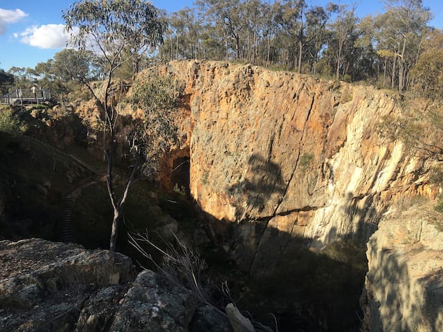
Wander through intriguing mini gorges and cliffs of fine pink clay. The colourful phenomenon was created by early gold-mining activities: sluicing work in the 1880s revealed the 'pink' hills near the historic town of Heathcote.
You'll find a variety of stones at this geological reserve, including smooth ironstone with a distinctive volcanic appearance. It's a great area for bushwalking and photography, so strap on your boots, grab your camera and get set to explore the unique landscape, wildflowers and wildlife.
Content: Visit Victoria
Source: https://www.visitmelbourne.com/regions/goldfields/things-to-do/nature-and-wildlife/national-parks-and-reserves/vv-pink-cliffs-reserve
10 ντόπιοι το προτείνουν
Pink Cliffs Reserve
68 Pink Cliffs RdWander through intriguing mini gorges and cliffs of fine pink clay. The colourful phenomenon was created by early gold-mining activities: sluicing work in the 1880s revealed the 'pink' hills near the historic town of Heathcote.
You'll find a variety of stones at this geological reserve, including smooth ironstone with a distinctive volcanic appearance. It's a great area for bushwalking and photography, so strap on your boots, grab your camera and get set to explore the unique landscape, wildflowers and wildlife.
Content: Visit Victoria
Source: https://www.visitmelbourne.com/regions/goldfields/things-to-do/nature-and-wildlife/national-parks-and-reserves/vv-pink-cliffs-reserve
For an easy fish. Look for koalas in this park. Rare sightings but we’ve seen them a few times.
This Seymour park has all the facilities you need for a day out - BBQs, toilets, shelter, accessible fishing platform and a playground. Progress St, Seymour
Goulburn Park
36 The EsplanadeFor an easy fish. Look for koalas in this park. Rare sightings but we’ve seen them a few times.
This Seymour park has all the facilities you need for a day out - BBQs, toilets, shelter, accessible fishing platform and a playground. Progress St, Seymour
The Great Victorian Rail Trail is a multi-use trail and can be explored on foot, bike or horse. This easily accessible, varied and unique rail trail offers close proximity to heritage classified rivers, majestic valleys, lakes and mountains.
Here are some great suggestions on the best way to enjoy the rail trail: https://onehourout.com.au/melbourne/goulburn-river-valley/cycling/the-great-victorian-rail-trail/
A shuttle service along the rail trail can be organised via the Tallarook General Store. Pick up service from Tallarook, Mansfield, Seymour, Yea, Broadford and Trawool, 10 passengers, bicycles and luggage. Contact Nigel or Vicky for a quote on 0435 852 385 or email tallarookstore@gmail.com
28 ντόπιοι το προτείνουν
Great Victorian Rail Trail
The Great Victorian Rail Trail is a multi-use trail and can be explored on foot, bike or horse. This easily accessible, varied and unique rail trail offers close proximity to heritage classified rivers, majestic valleys, lakes and mountains.
Here are some great suggestions on the best way to enjoy the rail trail: https://onehourout.com.au/melbourne/goulburn-river-valley/cycling/the-great-victorian-rail-trail/
A shuttle service along the rail trail can be organised via the Tallarook General Store. Pick up service from Tallarook, Mansfield, Seymour, Yea, Broadford and Trawool, 10 passengers, bicycles and luggage. Contact Nigel or Vicky for a quote on 0435 852 385 or email tallarookstore@gmail.com
Total distance is 10.5 kilometres. There are several deviations you can opt to investigate
Time to complete - 3-4 hours
Relative difficulty - Moderate
Loose stones make the track slippery; part of the track is steep and rough at the base of the Lookout. If this foot trail looks too daunting, keep walking along the road for 100m until you get to the Melville's Lookout 2km sign pointing left, which is a less demanding walk
Overview
Melville's Lookout is named after Captain (Francis) Melville, who was a notorious goldrush era bushranger. After being transported to Australia at age 15 for housebreaking, he escaped Port Arthur to live with local aborigines for a year. He came to Victoria in 1851. Within a short time he had formed the Mt Macedon Gang that robbed travellers heading to and from the goldfields.
Mt Black Quarry can be viewed from the Lookout track. Granite blocks were mined here to use in the construction of the Goulburn Weir wall in the 1890's.
This park comprises Victoria's largest remaining box – ironbark forest, consisting of open woodland including ironbark, grey and yellow box and stringy bark. The understory features blackwood, gold dust wattle, silver wattle and drooping cassinia. Grass trees are numerous. Green rock fern is a common ground plant in milder months.
Wildflowers include grassland wood sorrel, shiny everlastings, tall bluebells and Nodding Greenhood orchids, with many more according to the season. Rare spider orchids may be also found. For detailed track notes: https://www.strathbogie.vic.gov.au/images/Tourism/Natural-Attractions/20200525%20Melvilles%20Lookout%20tracks%20and%20trails%20brochure.pdf
Melvilles Lookout and Picnic Ground
Total distance is 10.5 kilometres. There are several deviations you can opt to investigate
Time to complete - 3-4 hours
Relative difficulty - Moderate
Loose stones make the track slippery; part of the track is steep and rough at the base of the Lookout. If this foot trail looks too daunting, keep walking along the road for 100m until you get to the Melville's Lookout 2km sign pointing left, which is a less demanding walk
Overview
Melville's Lookout is named after Captain (Francis) Melville, who was a notorious goldrush era bushranger. After being transported to Australia at age 15 for housebreaking, he escaped Port Arthur to live with local aborigines for a year. He came to Victoria in 1851. Within a short time he had formed the Mt Macedon Gang that robbed travellers heading to and from the goldfields.
Mt Black Quarry can be viewed from the Lookout track. Granite blocks were mined here to use in the construction of the Goulburn Weir wall in the 1890's.
This park comprises Victoria's largest remaining box – ironbark forest, consisting of open woodland including ironbark, grey and yellow box and stringy bark. The understory features blackwood, gold dust wattle, silver wattle and drooping cassinia. Grass trees are numerous. Green rock fern is a common ground plant in milder months.
Wildflowers include grassland wood sorrel, shiny everlastings, tall bluebells and Nodding Greenhood orchids, with many more according to the season. Rare spider orchids may be also found. For detailed track notes: https://www.strathbogie.vic.gov.au/images/Tourism/Natural-Attractions/20200525%20Melvilles%20Lookout%20tracks%20and%20trails%20brochure.pdf
Gooram Falls is a great place to visit for a relaxing day by the water. The two cascading falls are a part of Seven Creeks Wildlife Reserve, with the water source being Seven Creeks. There are two small falls roughly 20 metres apart surrounded by indigenous bushland and rocky outcrops. While you are there, you could explore the other natural attractions of the Strathbogie Ranges.
https://www.strathbogie.vic.gov.au/images/Tourism/Natural-Attractions/20200525%20Gooram%20Falls%20tracks%20and%20trails.pdf
18 ντόπιοι το προτείνουν
Gooram Falls Day Visitor Area
1813-1839 Euroa-Mansfield RdGooram Falls is a great place to visit for a relaxing day by the water. The two cascading falls are a part of Seven Creeks Wildlife Reserve, with the water source being Seven Creeks. There are two small falls roughly 20 metres apart surrounded by indigenous bushland and rocky outcrops. While you are there, you could explore the other natural attractions of the Strathbogie Ranges.
https://www.strathbogie.vic.gov.au/images/Tourism/Natural-Attractions/20200525%20Gooram%20Falls%20tracks%20and%20trails.pdf
Sit by the river in the lovely park area. Picnic amongst the huge trees or enjoy a walk along the trail which extends the entire length of Emily St in Seymour.
Walk the Goulburn River: The river walk in Seymour meanders along the length of Emily st and is a hidden gem. An easy to walk or ride with under magnificent large gum trees with lots of seating along the way and great for picnics at Lions Park or grab a burger from Burger Me and later a beer at the Royal Hotel or the Prince of Wales. There are interpretative and historic markers and information along the path. Look out for the new canoe scar tree in the car park near the boat ramp. Approximately 3km, depending on where you start. We recommend starting at the Somerset Winery Kitchen end at the old bridge.
https://www.creativespirits.info/aboriginalculture/land/aboriginal-scarred-trees
The Old Goulburn River Bridge, Seymour is of historic, scientific (technological) and aesthetic significance to the State of Victoria.
The bridge spans the crossing place of the Goulburn River on the historic Sydney Road, in use since a Victorian Government punt began operating at the site in 1853.
The Old Goulburn River Bridge is of historic significance for its association with one of Victoria's most important river crossings from 1853 until the diverting of the Hume Highway in 1966.
The Old Goulburn River Bridge is of historical significance in representing two major phases of road bridge construction in Victoria, being the last of the extravagant large timber road bridges of the 19th century and the oldest and most authentic surviving example of a large composite highway bridge of the new motor-vehicle pattern introduced by the Country Roads Board during the Great Depression era.
https://vhd.heritagecouncil.vic.gov.au/places/6157
Lions Park
Sit by the river in the lovely park area. Picnic amongst the huge trees or enjoy a walk along the trail which extends the entire length of Emily St in Seymour.
Walk the Goulburn River: The river walk in Seymour meanders along the length of Emily st and is a hidden gem. An easy to walk or ride with under magnificent large gum trees with lots of seating along the way and great for picnics at Lions Park or grab a burger from Burger Me and later a beer at the Royal Hotel or the Prince of Wales. There are interpretative and historic markers and information along the path. Look out for the new canoe scar tree in the car park near the boat ramp. Approximately 3km, depending on where you start. We recommend starting at the Somerset Winery Kitchen end at the old bridge.
https://www.creativespirits.info/aboriginalculture/land/aboriginal-scarred-trees
The Old Goulburn River Bridge, Seymour is of historic, scientific (technological) and aesthetic significance to the State of Victoria.
The bridge spans the crossing place of the Goulburn River on the historic Sydney Road, in use since a Victorian Government punt began operating at the site in 1853.
The Old Goulburn River Bridge is of historic significance for its association with one of Victoria's most important river crossings from 1853 until the diverting of the Hume Highway in 1966.
The Old Goulburn River Bridge is of historical significance in representing two major phases of road bridge construction in Victoria, being the last of the extravagant large timber road bridges of the 19th century and the oldest and most authentic surviving example of a large composite highway bridge of the new motor-vehicle pattern introduced by the Country Roads Board during the Great Depression era.
https://vhd.heritagecouncil.vic.gov.au/places/6157
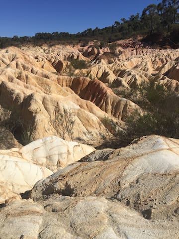
This is can be a ‘strange’ park. It can seem like it’s just space/land. You must look very, very hard for the tiny flora species. The tracks are not great. It’s easy to get lost. If you love native flowers & birds apparently it’s fabulous. It’s a spot we are yet to visit in our region. http://www.strathbogieranges.org.au/wp-content/uploads/20200813_bro_Mangalore-final-SM.pdf
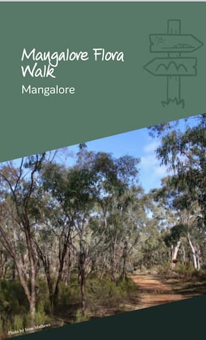
Mangalore Flora Park
This is can be a ‘strange’ park. It can seem like it’s just space/land. You must look very, very hard for the tiny flora species. The tracks are not great. It’s easy to get lost. If you love native flowers & birds apparently it’s fabulous. It’s a spot we are yet to visit in our region. http://www.strathbogieranges.org.au/wp-content/uploads/20200813_bro_Mangalore-final-SM.pdf
If you are looking for some quiet solitude or a peaceful walk with friends in a place that feels remote, this could be a place for you. It may be a bit out of the way, it may not be everyone’s cup of tea, but that probably explains the absence of evidence of visitation you see in some other places. It also means there is something more intimate about experiencing this place.
https://walkingmaps.com.au/walk/4762
Moormbool West
If you are looking for some quiet solitude or a peaceful walk with friends in a place that feels remote, this could be a place for you. It may be a bit out of the way, it may not be everyone’s cup of tea, but that probably explains the absence of evidence of visitation you see in some other places. It also means there is something more intimate about experiencing this place.
https://walkingmaps.com.au/walk/4762
Food & Drink Experiences
Put your feet up and make the most of your stay and arrange private transport to truly appreciate our gorgeous region:
Wine & Dine Tours https://www.winedinetours.com
Rambling Wine Tours https://ramblingwinetours.com/goulburn-valley/
Seymour Taxi 5792 1644
The Tallarook Farmers Market runs on the first Sunday of each month between 8:30am to 12pm. It is Mitchell Shire's only VFMA accredited market. Full of friendly faces and great food. Stop for coffee, brunch and shopping.
https://www.tallarookfarmersmarket.com.au

Tallarook
The Tallarook Farmers Market runs on the first Sunday of each month between 8:30am to 12pm. It is Mitchell Shire's only VFMA accredited market. Full of friendly faces and great food. Stop for coffee, brunch and shopping.
https://www.tallarookfarmersmarket.com.au
An interesting place for the serious whisky lover. A huge selection to choose from and with a number of whisky tasting options and gin. Devonshire tea is also on offer and a small food menu.

Killingworth Hill Cafe & Whisky Bar
36 Killingworth RdAn interesting place for the serious whisky lover. A huge selection to choose from and with a number of whisky tasting options and gin. Devonshire tea is also on offer and a small food menu.
The Meat Room - Providore is open Friday 9am-5pm and Saturday 9am to 12pm. For the best small batch salami stop in at Kilmore East, on your way to Blue Tongue Berries so you can enjoy a delicious platter during your stay. The range of salami available includes; Zingara, Felino mild, Toulouse, Calabrese, Fennel Salami and Brucia culo. There are also sausage making classes and events. https://themeatroom.com.au/learn-from-us/
The Meat Room
Marions LaneThe Meat Room - Providore is open Friday 9am-5pm and Saturday 9am to 12pm. For the best small batch salami stop in at Kilmore East, on your way to Blue Tongue Berries so you can enjoy a delicious platter during your stay. The range of salami available includes; Zingara, Felino mild, Toulouse, Calabrese, Fennel Salami and Brucia culo. There are also sausage making classes and events. https://themeatroom.com.au/learn-from-us/
Sightseeing
Welcome to Taungurung Country. Here are our top picks for things to do around Seymour and the region. Most places are free to enter but during these Covid times please ring venues to check if open. Enjoy our beautiful region. Nick and Cynthia
https://issuu.com/gonagambie/docs/take-natures-roadtrip
https://www.mitchellshire.vic.gov.au/our-region/discovermitchell
This walk meanders amidst native trees and grasses that resemble rubber trees and rice paddies. Plants synonymous with Vietnam. 106 panels of DigiGlass with the name of every Serviceman and Servicewoman who served in their various capacities. Behind the names is the picture story of the Vietnam conflict and the wall is lite of an evening.
Vietnam Veterans Commemorative Walk
High StreetThis walk meanders amidst native trees and grasses that resemble rubber trees and rice paddies. Plants synonymous with Vietnam. 106 panels of DigiGlass with the name of every Serviceman and Servicewoman who served in their various capacities. Behind the names is the picture story of the Vietnam conflict and the wall is lite of an evening.
Walking into the cellar door is like walking back in time. The cellar walls are constucted of hand-made bricks and mud-stone quarried on the Estate. The supporting beams and pillars were cut from redgum and iron bark growing on the property. If you look up the original shingles can still be seen. Take the opportunity to taste Tahbilk wines as you engross yourself in the history of the place. A unique experience which is not to be missed.
Source: http://www.tahbilk.com.au/visit-us/wineries-victoria.html
26 ντόπιοι το προτείνουν
Tahbilk - Cellar Door
254 Oneils RdWalking into the cellar door is like walking back in time. The cellar walls are constucted of hand-made bricks and mud-stone quarried on the Estate. The supporting beams and pillars were cut from redgum and iron bark growing on the property. If you look up the original shingles can still be seen. Take the opportunity to taste Tahbilk wines as you engross yourself in the history of the place. A unique experience which is not to be missed.
Source: http://www.tahbilk.com.au/visit-us/wineries-victoria.html
The KMR is a unique railway built to two-foot (610 mm) gauge on a zig-zag formation.
To gain the maximum height within the shortest distance, steep grades and tight curves also abound,with panoramic views of (360 degrees) to take your breath away at ‘Summit Station’.
We are situated in the North East corner of the Tallarook Ranges, North Central Victoria, Australia.
The railway and museum has been developed by a group of dedicated volunteers over a fifteen year period and is a not for profit incorporated body.
Source: https://www.kerrisdalemountainrailway.com
Kerrisdale Mountain Railway and Museum
7523 Goulburn Valley HwyThe KMR is a unique railway built to two-foot (610 mm) gauge on a zig-zag formation.
To gain the maximum height within the shortest distance, steep grades and tight curves also abound,with panoramic views of (360 degrees) to take your breath away at ‘Summit Station’.
We are situated in the North East corner of the Tallarook Ranges, North Central Victoria, Australia.
The railway and museum has been developed by a group of dedicated volunteers over a fifteen year period and is a not for profit incorporated body.
Source: https://www.kerrisdalemountainrailway.com
The construction of a weir on the Goulburn River began in 1887, and was completed in 1891. The Goulburn Weir was the first major diversion structure built for irrigation in Australia and was considered very advanced for the time. Such was the regard for the structure, it appeared on the reverse of Australian half sovereign and ten shilling banknotes from 1913 until 1933.
Goulburn Weir is a concrete structure founded on bedrock, with its downstream face stepped with granite blocks quarried from the nearby Mt Black.
https://www.g-mwater.com.au/water-resources/catchments/storages/goulburn/goulburnweir
To better understand the Nagambie water ways go to:
https://www.g-mwater.com.au/downloads/gmw/Recreation/06012016_-_4113297-v1-RECREATION_GUIDE_-_NAGAMBIE_WATERWAYS_STRATHBOGIE_SHIRE_.pdf
Goulburn Weir
The construction of a weir on the Goulburn River began in 1887, and was completed in 1891. The Goulburn Weir was the first major diversion structure built for irrigation in Australia and was considered very advanced for the time. Such was the regard for the structure, it appeared on the reverse of Australian half sovereign and ten shilling banknotes from 1913 until 1933.
Goulburn Weir is a concrete structure founded on bedrock, with its downstream face stepped with granite blocks quarried from the nearby Mt Black.
https://www.g-mwater.com.au/water-resources/catchments/storages/goulburn/goulburnweir
To better understand the Nagambie water ways go to:
https://www.g-mwater.com.au/downloads/gmw/Recreation/06012016_-_4113297-v1-RECREATION_GUIDE_-_NAGAMBIE_WATERWAYS_STRATHBOGIE_SHIRE_.pdf
Named after John Murchison an original squatter of one of the three original squatting runs in the district, this lookout sits right on the boundary of the Murrindindi region. A great platform juts out from the side of the hill here and it is a killer sunrise spot with the sun coming up behind the hills beyond. This area is known as the 'Valley of a Thousand Hills' and if you catch it in the right light with overlapping silhouettes you will see why.
There are seats on the viewing platform and under the trees is a shaded table and seat. It's the perfect spot for not only spectacular photo opportunities but also a picnic with an epic view.
Content: Murrindindi Shire Council
Source: https://www.visitvictoria.com/regions/High-Country/Things-to-do/Nature-and-wildlife/Scenic-Lookouts/Murchison-Gap-Lookout
Murchison Gap Lookout
Murchison Spur RoadNamed after John Murchison an original squatter of one of the three original squatting runs in the district, this lookout sits right on the boundary of the Murrindindi region. A great platform juts out from the side of the hill here and it is a killer sunrise spot with the sun coming up behind the hills beyond. This area is known as the 'Valley of a Thousand Hills' and if you catch it in the right light with overlapping silhouettes you will see why.
There are seats on the viewing platform and under the trees is a shaded table and seat. It's the perfect spot for not only spectacular photo opportunities but also a picnic with an epic view.
Content: Murrindindi Shire Council
Source: https://www.visitvictoria.com/regions/High-Country/Things-to-do/Nature-and-wildlife/Scenic-Lookouts/Murchison-Gap-Lookout
The historic Cheviot Tunnel is a key feature of the Tallarook to Mansfield Rail Line which operated between 1883 and 1970 and now the Great Victorian Rail Trail open to walkers, cyclists and horse riding enthusiasts. The Great Victorian Rail Trail meanders through undulating farmland along the majestic gum lined Goulburn River with stunning views into the foothills of the Victorian High Country.
Being the only tunnel on this line, and made using handmade bricks using local clay, which remain in excellent condition today it has tremendous heritage values.
The Cheviot Tunnel was constructed to pass trains across the Black Range at McLoughlin’s Gap roughly half way between Yea and Molesworth.
The tunnel was constructed from an estimated 675,000 handmade bricks using local clay. This was sourced from Quinlan’s pit in a nearby paddock just west of the Tunnel. Some steel hooks that held lanterns in emergencies still exist near the four indented safety alcoves. These are located at regular intervals along the eastern wall.
The Cheviot Tunnel is situated between the towns of Yea and Molesworth on the Great Victorian rail Trail.
Source: https://www.greatvictorianrailtrail.com.au/listing/cheviot-tunnel-yea/
7 ντόπιοι το προτείνουν
Cheviot Railway Tunnel H.A
406 Cheviot RdThe historic Cheviot Tunnel is a key feature of the Tallarook to Mansfield Rail Line which operated between 1883 and 1970 and now the Great Victorian Rail Trail open to walkers, cyclists and horse riding enthusiasts. The Great Victorian Rail Trail meanders through undulating farmland along the majestic gum lined Goulburn River with stunning views into the foothills of the Victorian High Country.
Being the only tunnel on this line, and made using handmade bricks using local clay, which remain in excellent condition today it has tremendous heritage values.
The Cheviot Tunnel was constructed to pass trains across the Black Range at McLoughlin’s Gap roughly half way between Yea and Molesworth.
The tunnel was constructed from an estimated 675,000 handmade bricks using local clay. This was sourced from Quinlan’s pit in a nearby paddock just west of the Tunnel. Some steel hooks that held lanterns in emergencies still exist near the four indented safety alcoves. These are located at regular intervals along the eastern wall.
The Cheviot Tunnel is situated between the towns of Yea and Molesworth on the Great Victorian rail Trail.
Source: https://www.greatvictorianrailtrail.com.au/listing/cheviot-tunnel-yea/
Food scene
Here's a few of our local favourites for meals -

The Winery Kitchen
1 Emily St
Baba's kitchen
32 Station St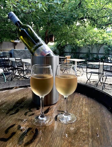
The Brewer's Table
42 Station StMitchelton Wines
470 Mitchellstown RdThe Trawool Estate
8150 Goulburn Valley Hwy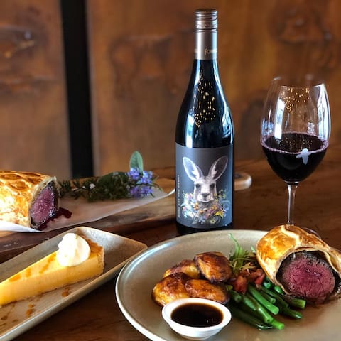
Fowles Wine
1175 Lambing Gully RdBank Street Wood Fired Pizza & Gardens
5 Bank StHarvest Home Avenel
1 Bank St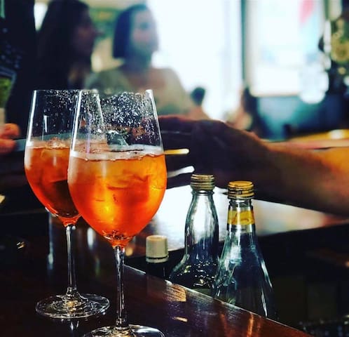
Tallarook Hotel
15 Main RdNagambie Brewery and Distillery
295 High St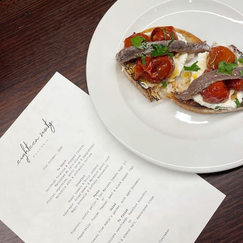
Eighteen Sixty Wine Bar
312B High St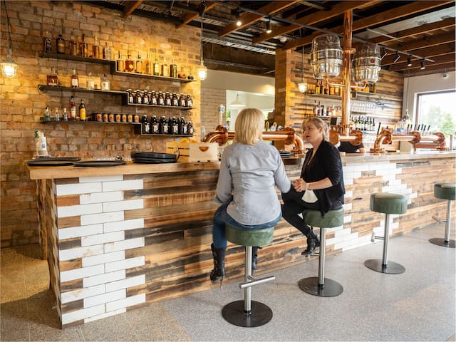
The Prince Seymour
48 Emily StTahbilk - Cellar Door
254 Oneils RdSilver Princess
2 Main RoadBlue Tongue Berries
445 Northwood RdArt
Welcome to Taungurung Country. Here are our top arty picks. Most places are free to enter but during these Covid times please ring venues to check if open. Enjoy the talents in our region. Nick and Cynthia
The Mitchelton Gallery of Aboriginal Art was established by Adam Knight and Gerry Ryan OAM, who share a passion for Indigenous Australian art.
Exhibiting the outstanding work that continues to be produced in this field today, the gallery was created to provide an inspiring new space for locals and visitors to experience the artworks of Australia’s First People.
Works on display here are representative of over 15 different art centres and communities throughout Australia, including our local Taungurung Clan.
Source: https://mitchelton.com.au/gallery/
32 ντόπιοι το προτείνουν

Mitchelton Wines
470 Mitchellstown RdThe Mitchelton Gallery of Aboriginal Art was established by Adam Knight and Gerry Ryan OAM, who share a passion for Indigenous Australian art.
Exhibiting the outstanding work that continues to be produced in this field today, the gallery was created to provide an inspiring new space for locals and visitors to experience the artworks of Australia’s First People.
Works on display here are representative of over 15 different art centres and communities throughout Australia, including our local Taungurung Clan.
Source: https://mitchelton.com.au/gallery/
Curly Flat Sculpture Park: Want to explore your own private sculpture park? Our friend has built one in Tallarook and we have the key. We'll also provide you with a map and details. Open for private viewing by appointment only.
http://www.curlyflatsculpturepark.com.au
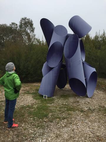
Scotts Road
Scotts RoadCurly Flat Sculpture Park: Want to explore your own private sculpture park? Our friend has built one in Tallarook and we have the key. We'll also provide you with a map and details. Open for private viewing by appointment only.
http://www.curlyflatsculpturepark.com.au
Highlands is situated between Seymour and Yea. A lovely drive through rolling hills and home to many artists including Darren Gilbert http://monkeytaildesign.com
Dennis Spiteri http://www.dennis-spiteri.com/studio.html
Land Print Studio
Studios are open by appointment or on special occasions. Check individual websites for details.
Highlands
Highlands is situated between Seymour and Yea. A lovely drive through rolling hills and home to many artists including Darren Gilbert http://monkeytaildesign.com
Dennis Spiteri http://www.dennis-spiteri.com/studio.html
Land Print Studio
Studios are open by appointment or on special occasions. Check individual websites for details.
Open by appointment and only for serious collectors and antique-hunters. Right across the road from Blue Tongue Berries.
Victorian Railway Workshops, Art & Antiques was established by Sylvia & Kosta Kostoski, who have been trading as Antique Dealers since 1985.
From the beginning, we incorporated both formal and industrial antique pieces in our shop.
By 1987 we had secured the contract with the Victorian Railways, to dispose of all surplus to requirement pre privatisation. The Victorian Railways was full of beautiful Industrial Revolution period furniture and artifacts that had been used since the 1870’s
Unlike Europe and America, here in Australia, the need to fulfill war machines for WWI and WWII didn’t require the melting down of metals, alloys and wood to fire the furnaces, so it was all there in situ being used and usable.
It was a pleasure and privilege to be removing all that Australian heritage material including: furniture, artifacts and historical relics.
It took us 13 years to fulfill our obligation to the Victorian Railways, by which time we had secured the majority of the surplus heritage material.
Victorian Railway Workshops Art & Antiques PTY LTD
25 Smales RdOpen by appointment and only for serious collectors and antique-hunters. Right across the road from Blue Tongue Berries.
Victorian Railway Workshops, Art & Antiques was established by Sylvia & Kosta Kostoski, who have been trading as Antique Dealers since 1985.
From the beginning, we incorporated both formal and industrial antique pieces in our shop.
By 1987 we had secured the contract with the Victorian Railways, to dispose of all surplus to requirement pre privatisation. The Victorian Railways was full of beautiful Industrial Revolution period furniture and artifacts that had been used since the 1870’s
Unlike Europe and America, here in Australia, the need to fulfill war machines for WWI and WWII didn’t require the melting down of metals, alloys and wood to fire the furnaces, so it was all there in situ being used and usable.
It was a pleasure and privilege to be removing all that Australian heritage material including: furniture, artifacts and historical relics.
It took us 13 years to fulfill our obligation to the Victorian Railways, by which time we had secured the majority of the surplus heritage material.